G'day Elliot,
LIDAR is definitely becoming more available and is the technology that will probably become the most mainstream and it can't come early enough. I dream that in the next 5-10 years that the world's ag lands will be LIDAR'd (or otherwise) and that GoogleEarth will have this data there ready to go for this and the next (re) generation of regenerative agriculture designers.
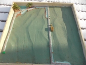
For now though we mainly use RTK GPS that is either generated from 'precision farming' devices or from company's such as FarmingIT (
http://www.farmingit.com.au/) here in Australia who survey using a quad-bike mounted kit and traverse a landscape giving us a detailed topo for $8/ha or $3.50/acre which is pretty bloody reasonable given that total station surveys used to cost me 10-15 times this!
If your clients (and you!) value water then they need to be in control of it and 'Landshape' is second behind 'Climate' in the 'Keyline Scale of Permanence' as it is in our 'Regen10' in which we've replaced Landshape with 'Geography'. To control water you need an effective and accurate topo map and we've proven that this is possible using techniques such as 'Making contours on the cheap' (
http://permaculturenews.org/2008/09/11/making-contour-maps-on-the-cheap/)and now with tech such as the FarmingIT quad...Broader scale LIDAR use by agencies and the open-source sharing of this data only completes the picture...
Thanks and all the best,
Darren