gift
Rocket Mass Heater Manual
will be released to subscribers in: soon!
  • Post Reply Bookmark Topic Watch Topic
  • New Topic
permaculture forums growies critters building homesteading energy monies kitchen purity ungarbage community wilderness fiber arts art permaculture artisans regional education skip experiences global resources cider press projects digital market permies.com pie forums private forums all forums
this forum made possible by our volunteer staff, including ...
master stewards:
  • Carla Burke
  • Nancy Reading
  • r ranson
  • Jay Angler
  • John F Dean
  • Pearl Sutton
stewards:
  • Nicole Alderman
  • paul wheaton
  • Anne Miller
master gardeners:
  • Christopher Weeks
  • Timothy Norton
gardeners:
  • thomas rubino
  • Jeremy VanGelder
  • Matt McSpadden

google earth elevation accurate?

 
Posts: 9
  • Mark post as helpful
  • send pies
    Number of slices to send:
    Optional 'thank-you' note:
  • Quote
  • Report post to moderator
Is google earth accurate enough to get a good idea of how swales will be laid out on a property? I know it's not perfect and it is no substitute to a laser or A frame level, but in the google earth program you can take your pointer and go over the land and it gives you elevation down to the foot. However when I go over something like a barn it does not pick up the elevation change.
 
Posts: 156
9
  • Mark post as helpful
  • send pies
    Number of slices to send:
    Optional 'thank-you' note:
  • Quote
  • Report post to moderator
I have found that importing the google date to sketch-up can give you a good rough starting point.
Your last sentence is telling in that it does miss what are major elevation changes for a landholder.
I have seen it gloss over 15' drops.
So, good rough idea, yes.
I think most maps, even super detailed, can only take you so far.
This thread here shows some of the limitations of google maps for this purpose.
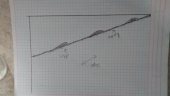
For example, the house-- on the lower left side of the sketch-up file I loaded onto thread -- has about a 12' drop right next to it that googlemaps glosses over.
And other minor issues.
So, this gives a good starting point.
I forget where I read it, but something like "Don't mistake the map for the territory" (P.A. Yoeman I think) certainly applies in this example, and for me is appropriate in all cases of map vs. actual land.
Maps are great, but only offer so much for planning in the manner I like.
Hope that helps.
 
steward
Posts: 7926
Location: Currently in Lake Stevens, WA. Home in Spokane
353
  • Mark post as helpful
  • send pies
    Number of slices to send:
    Optional 'thank-you' note:
  • Quote
  • Report post to moderator
I believe that the "My Topo" maps that Google uses are quite old.
I was looking at a property that My Topo showed at the end of a 'Jeep Trail'. Today, it is a 2 lane asphalt road. There were half a dozen homes there (built in the 50's) that did not show up on the map, but several others that weren't there any longer - replaced by decades of woods.

Topography maps seldom get updated. And most of 'em are based on WWII technologies.


Posts: 10
Location: White Springs Florida 32096
  • Mark post as helpful
  • send pies
    Number of slices to send:
    Optional 'thank-you' note:
  • Quote
  • Report post to moderator
Researching this topic for myself just this morning ... it seems that google earth uses SRTM data (http://productforums.google.com/forum/#!msg/earth/bqhjBZAWctM/W4V5yCNj27AJ) which is from the space shuttle.... http://en.wikipedia.org/wiki/Shuttle_Radar_Topography_Mission data - it is pretty high tech but still "averages" things out. In the US it uses 30 meter centers elsewhere they are 90 meters.
 
passwords must contain 14 characters, a number, punctuation, a small bird, a bit of cheese and a tiny ad.
Learn Permaculture through a little hard work
https://wheaton-labs.com/bootcamp
reply
    Bookmark Topic Watch Topic
  • New Topic