|

|
|
|
|

|

|

|

|

|


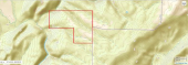
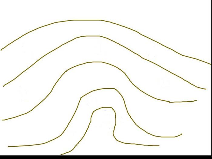
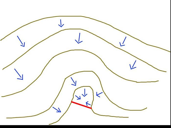
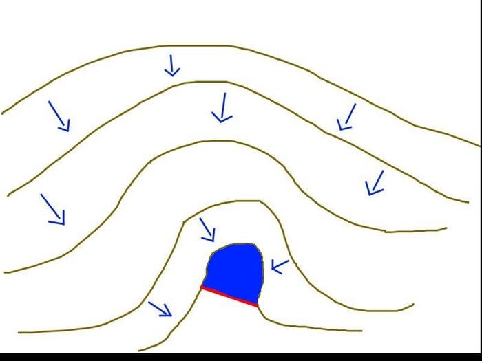
 The lines are 10 ft degradation. The far right near the bottom is a small peak, and the rest of the map is basically a hill descending from that (right to left). If it is too incomplete for you to work with, don't worry about it
  1
1
How permies.com works
What is a Mother Tree ?

Skill verified by gir bot") 1
1
1
1

How permies.com works
What is a Mother Tree ?
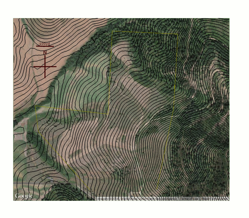
J.F. Sebastian wrote:Hey, that effect is awesome! I like it! That sort of thing could be quite helpful for a landowner, and definitely for a designer that they could show as part of their presentation to a client -- if you could streamline the process you could probably sell it.
A few observations:
1- The lines aren't quite right, as you say. Overall it is quite good, but I see a few places where the water flow doesn't line up with what it should be doing based on the contour lines or the landscape. Doesn't matter here, as this model plus the contour maps give me a good idea of what is happening.
2- I think it would be needed overall to take into account not just what falls on a property, but also rainfall onto the catchment area that *drains into* the property. In my case that isn't such a giant difference since I'm nearly at the top of the butte (and anyway I didn't give you maps that included that data), but in most cases this is where the majority of the flowing water comes from, and it can make modeling just the direct rainfall quite misleading depending on the terrain.
3- If you could sanely model potetial dams and swale flows, that would be *extremely* helpful to people, I think
4- Overall a steeper camera angle looking into the land is more useful (my opinion, at least). The tilt and pan is slick, but I expect the most valuable view is probably a top-down fixed look.
5- I like it!
6- I wish this property had better dam sites in the top half. The only natural spot my amateur eye sees in the top half is in a deeply forested gully/thicket, so damming it would be hard and overly disruptive. There is also a small spring or seep in there I think, which needs further exploration.

Skill verified by gir bot")

Skill verified by Mike Haasl") 1
1
1
1


|
Look at the smile on this tiny ad!
earth skills program
https://wheaton-labs.com/bootcamp
|