Hi everyone,
I'm a long-time permies follower and first-time poster. I've included a quick summary, with the full story underneath.
TL;DR: After struggling to draw a design for our own PDC project in 2023, we spent three years building Permiehub - a purpose-built, powerful, yet easy-to-use permaculture design software. We know this kind of software isn't for everyone (pencil and paper are awesome too!), but if you are actually looking for design software, Permiehub can simplify your work by importing contours, aerial imagery, sun path and more. It features a lot of built-in tools, including a food forest/syntropic agroforestry planting row tool. It's free for a single personal project - we'd love for you to try it for your next project!
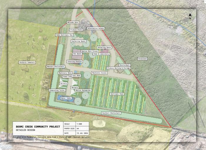
My partner and I did our PDC in 2023. When creating the design for our place as a PDC project, we found it quite difficult to get started and create an in-scale base map.
At that time, we couldn't find any "permaculture design software", so used Inkscape to draw our design. It worked, however, it was a bit time consuming and didn't quite do some things we wanted (it is a generic drawing tool, so completely understandable).
So, back in 2023, being software engineers, we started building a tool that would help permaculture students, land stewards & designers with drawing permaculture/ecological landscape designs. We named it Permiehub.
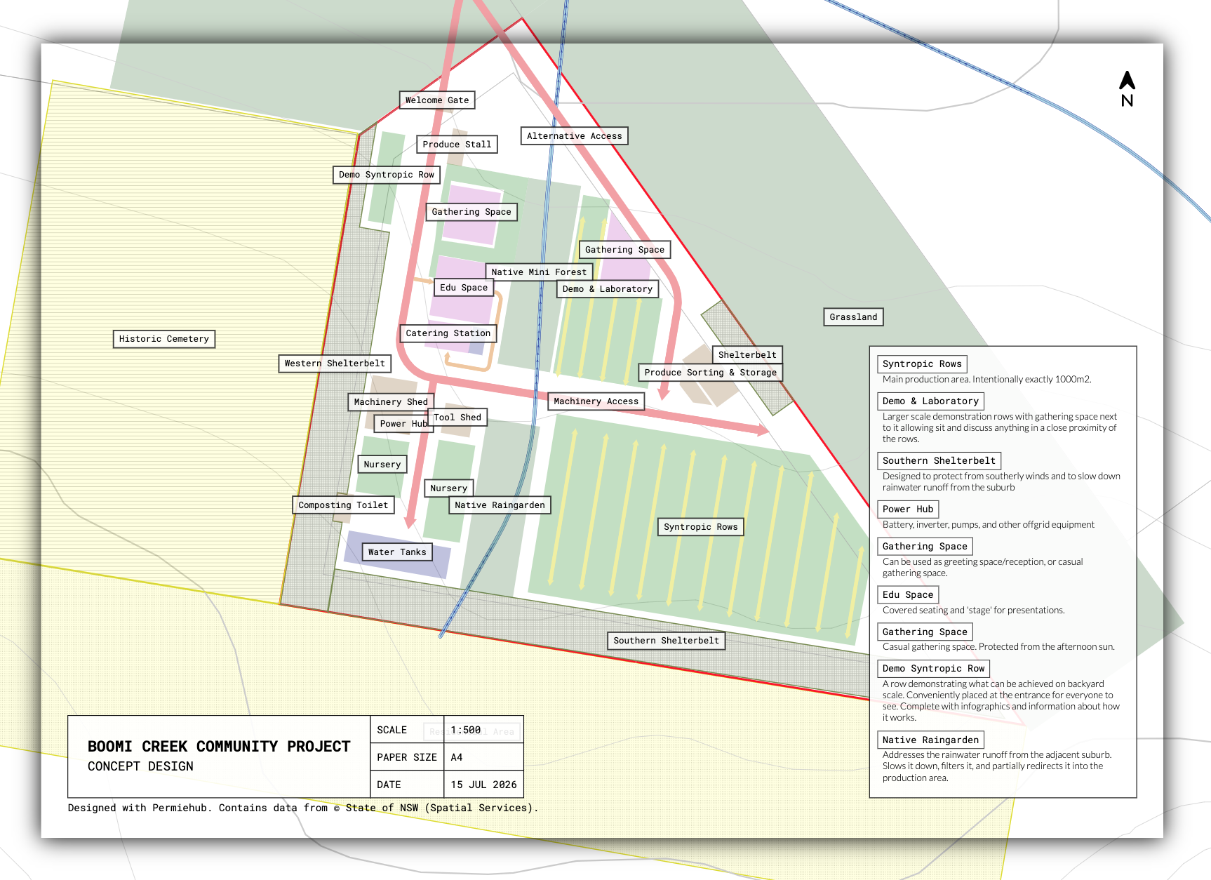
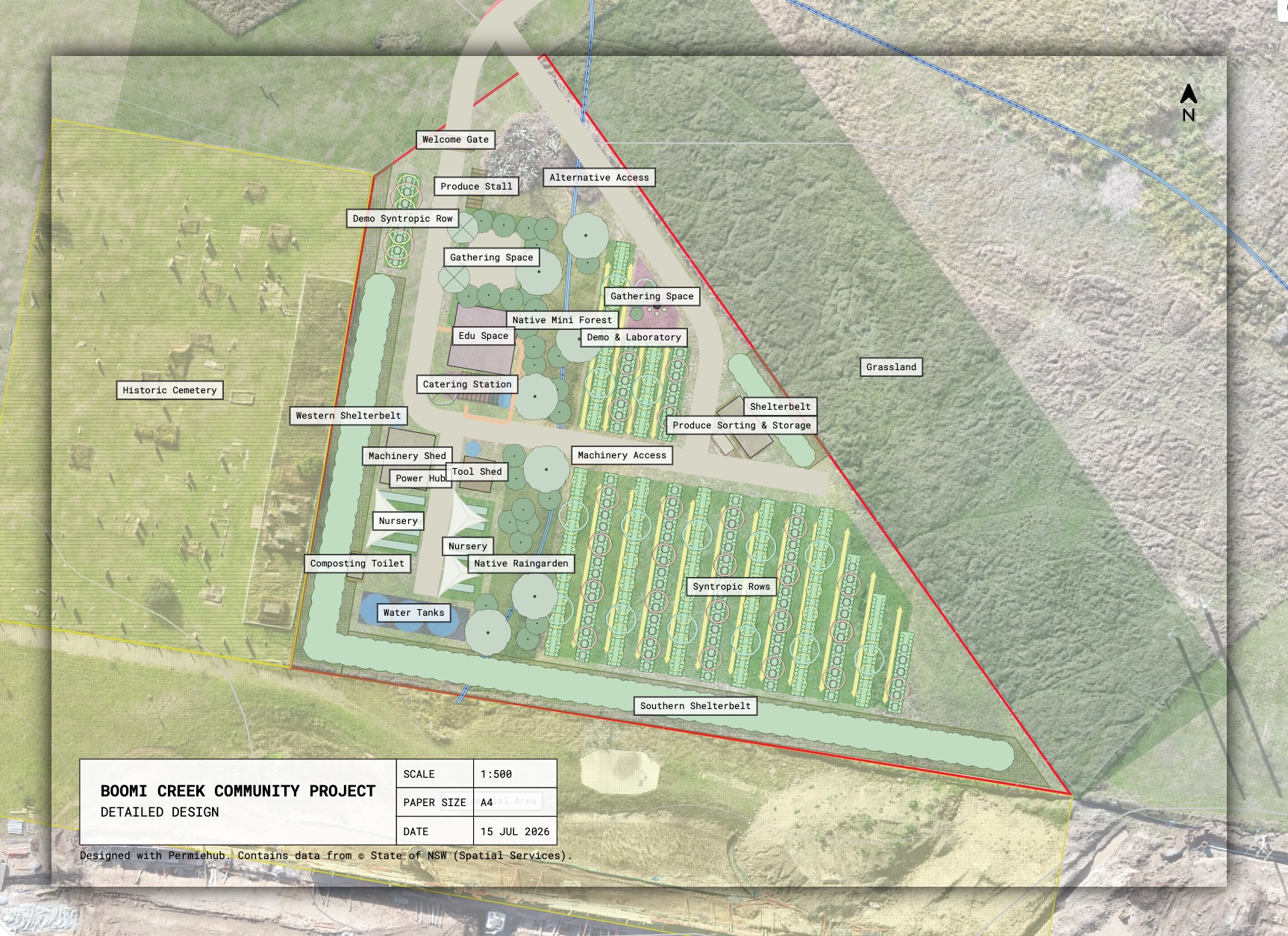
It is designed around the permaculture design process: 1. Base Map, 2. Site Analysis, 3. Concept Design (zones) & 4. Detailed Design (implementation details).
Simplified Base Map Creation
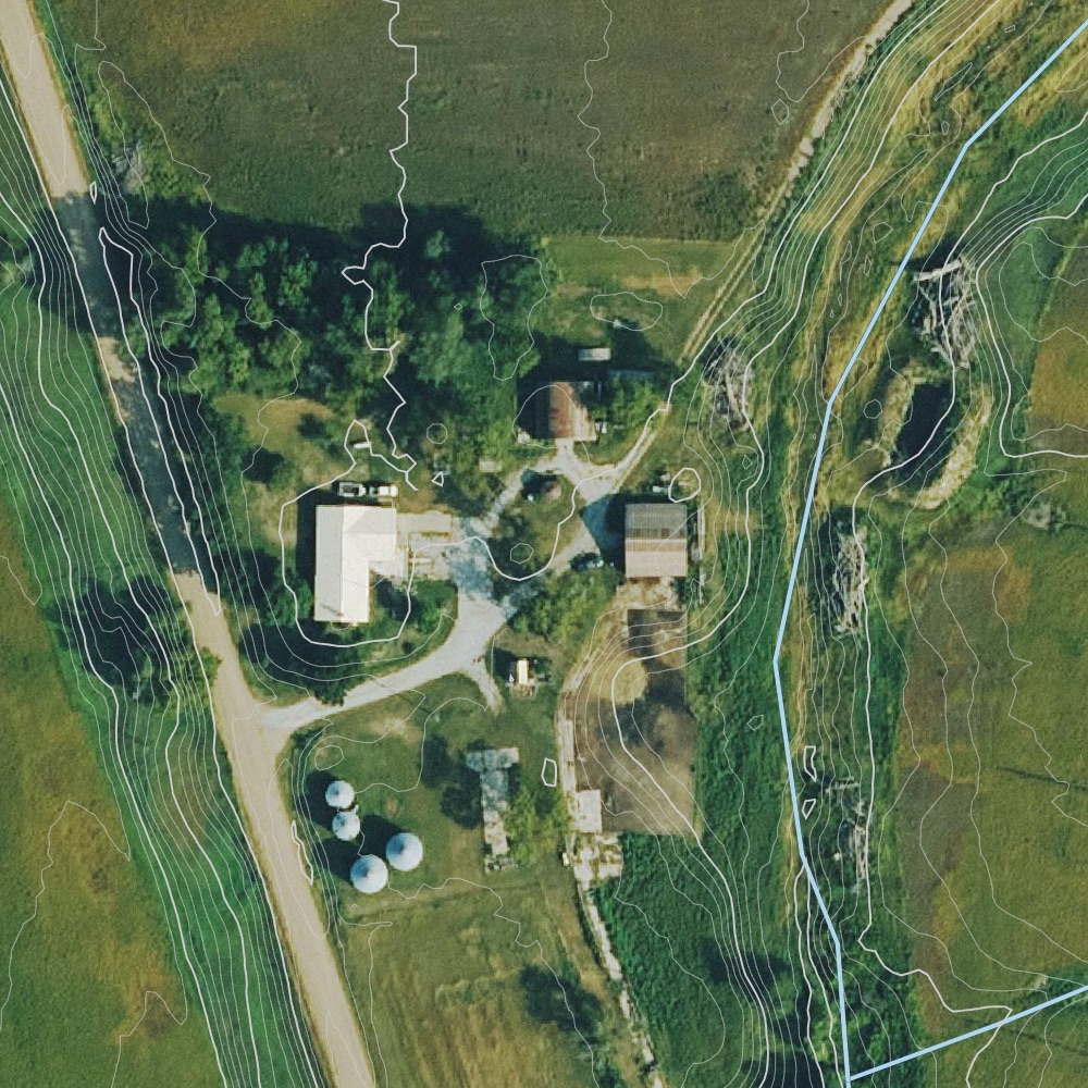
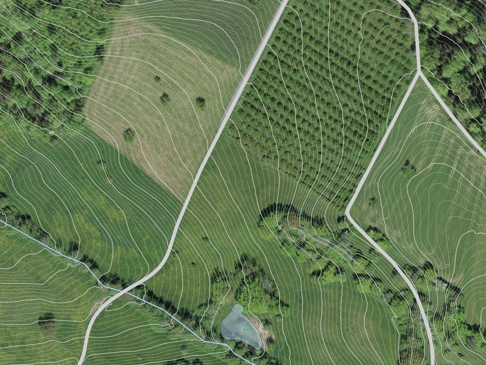
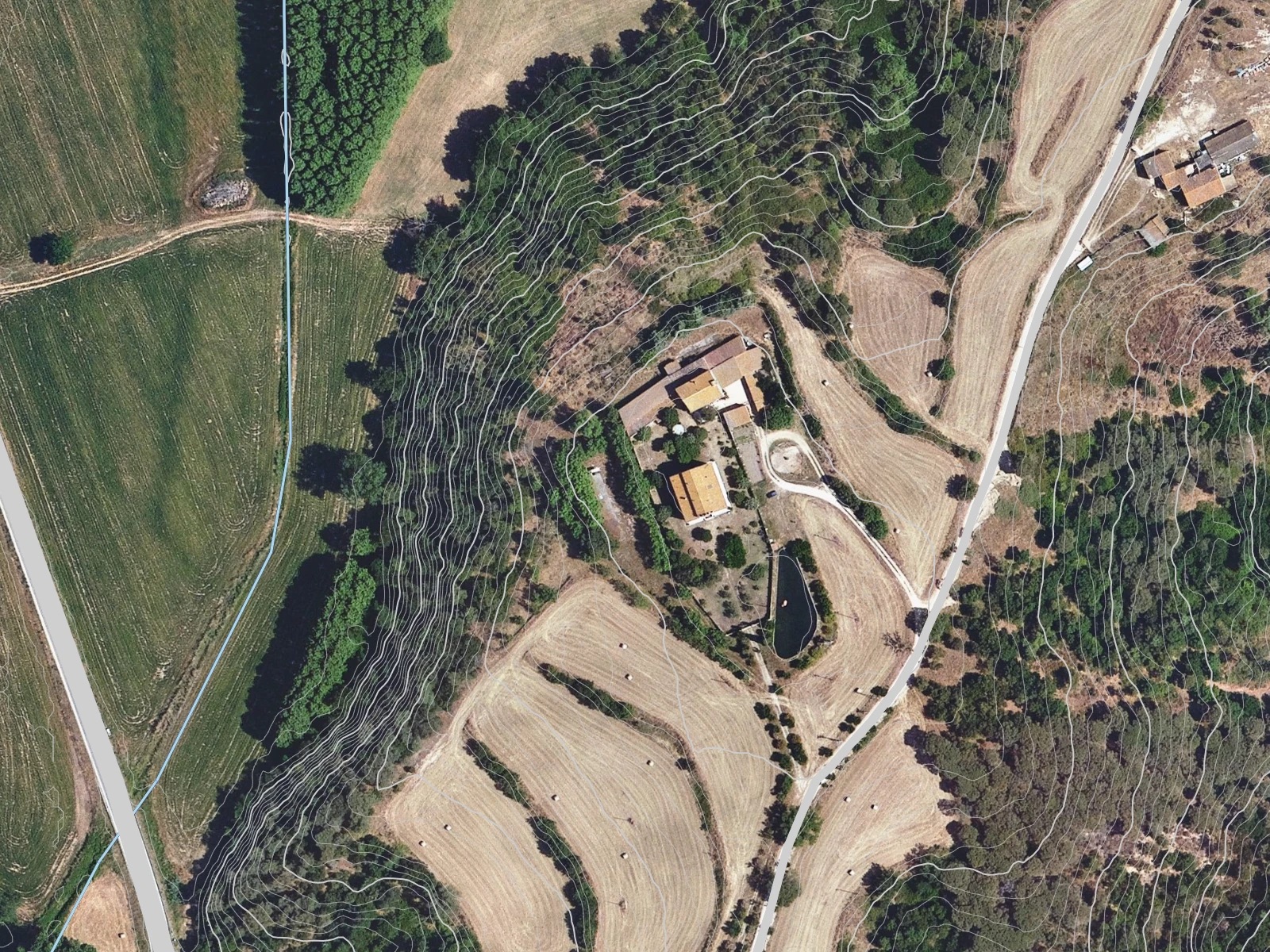
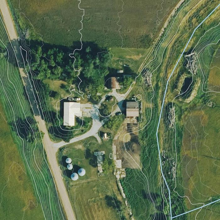
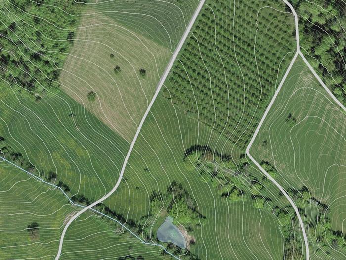
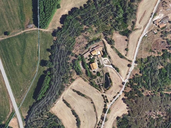
One of the main things we wanted to simplify as much as possible is the first step - creating a base map. We've integrated open data sources - initially in Australia, later New Zealand, and this week we launched world-wide support which integrates data sources like DEM/LiDAR-powered contours, OpenStreetMap, and number of national data sources (e.g. aerial imagery for USA, Australia, New Zealand, Spain, Switzerland and Czech Republic).
This means that depending on your location, it can import contours (up to 1ft / 0.5m intervals), aerial imagery, water bodies (creeks, rivers, lakes, ponds), roads, building outlines powerlines, and power poles. Property boundaries currently available in AU and NZ.
However, no matter where you are, you can always upload your own imagery like satellite imagery, drone orthophotos, or site plans - and use that as a base to layer your entire design.
(full quality images including attribution are below)
 Site Analysis
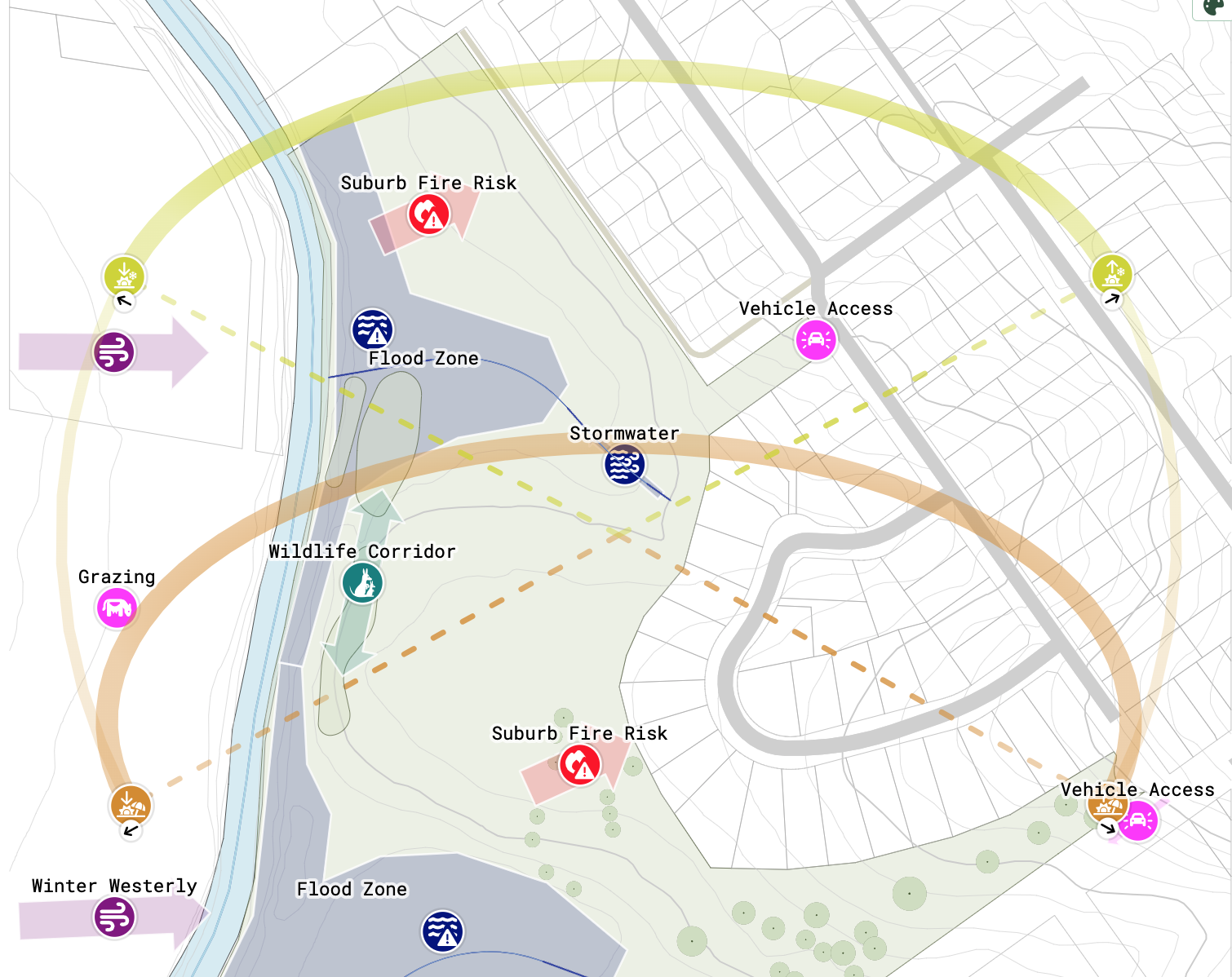
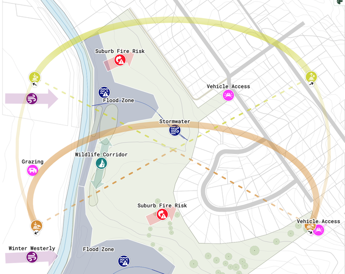
On top of the base map, you can then layer site analysis elements. The sun path is automatically generated based on a selected location. You can also place markers to visualize other site aspects such as wind direction, fire risk, flood risk using a built-in library of permaculture markers which also serves as a suggestion of what you may want to record.
 Concept Design
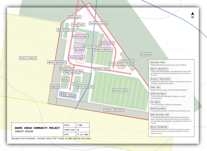
Concept design allows you to design rough zones and communication paths (i.e. how people/vehicles will move around the property).
 Detailed Design
Lastly, in the Detailed design layer, you can design your zones in detail - like placing objects like paths/roads, structures, garden beds, trees, and more.
Some time ago, we got interested in Syntropic Agroforestry and built a 'Planting Row' tool specifically built for row-based food forests and syntropic agroforestry rows. It's a powerful tool with presets for food forests & agroforestry, but you can also define your own spacings, species, and visualize them. Once you define the pattern, you can still change the shape of the planting row and counts of plants will be automatically recalculated - super useful when purchasing or propagating plants for the project.
Built with Permaculture Community in mind
We know a digital tool like this isn't for everyone, and many people prefer a pencil and paper or desktop tools like open-source QGIS - that’s completely fair. Our main goal is to make the entry point as smooth as possible for people trying to get their designs off the ground. And even those who prefer pencil and paper can still easily generate and print out an in-scale base map from Permiehub and then continue on paper. For those who use QGIS, I'm happy to elaborate on the data sources we use.
To support the permaculture community, Permiehub has a free "community plan" for a single personal project. For designers who need multiple complex projects, we have paid subscriptions. Every single bit of income goes directly right back into future development and supporting people with the community plan.
Permiehub is already pretty powerful, but of course - there is always room for improvement. We have lots of ideas we want to build or improve, however, we want to hear from you so we prioritize things that matter to you.
So if you are looking for a permaculture design software (like we were 3 years ago!), give Permiehub a go and let us know your thoughts.
Looking forward to chatting in the thread or privately!
Petr
If this sounds interesting:
- Sign up for the free community plan using this link:
https://designer.permiehub.com/home?code=permies
- Learn more in a live webinar - join us this Friday (in US timezone) -
https://permiehub.com/webinars
- Help centre & video tutorials -
https://permiehub.com/learn
- Feel free to follow our journey on Facebook or Instagram (search for "Permiehub")





 2
2