• Post Reply Bookmark Topic Watch Topic
  • New Topic
permaculture forums growies critters building homesteading energy monies kitchen purity ungarbage community wilderness fiber arts art permaculture artisans regional education skip experiences global resources cider press projects digital market permies.com pie forums private forums all forums
this forum made possible by our volunteer staff, including ...
master stewards:
  • Carla Burke
  • John F Dean
  • Nancy Reading
  • r ranson
  • Jay Angler
  • Pearl Sutton
stewards:
  • paul wheaton
  • Devaka Cooray
  • Leigh Tate
master gardeners:
  • Timothy Norton
  • Christopher Weeks
gardeners:
  • Jeremy VanGelder
  • Matt McSpadden
  • thomas rubino

Just bought some land, now to plan!

 
Posts: 31
1
  • Mark post as helpful
  • send pies
    Number of slices to send:
    Optional 'thank-you' note:
  • Quote
  • Report post to moderator
Hi guys and gals, I've been lurking here for a while but this is my first post, go easy!
My girlfriend and I have recently bought a 1ha plot in central Portugal, we plan on moving there within the next 2 years to start a self sufficient-ish life away from the stress of a "normal" life.
The piece of land is stunning, we have amazing SW facing views across a valley, plenty of sunshine and an abundance of water from 2 springs that were both still overflowing at the end of summer when we were out there. There are 3 terraces already cut into the valley marked in white (we're nestled between 2 ridges running roughly N-S) but I would like to make use of the slopes on either side too.

The East side (shown in blue) is fairly steep with good soil that I think is already partly terraced but I won't know for sure until we clear the area. There is a small stone shed here and will probably be the site of our future house. The west side is a steep, rocky slope with a few medronho bushes on the bottom half of the slope. (yellow area) The top half is covered by approximately 100 mature eucalyptus trees (underneath the track in the red area) which will eventually be used for building wood. The track running through the red area runs along the ridge of the hill, the other side of the track on the west facing slope is all mature pine trees.

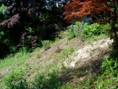
Now for the plan so far. First on the agenda is to clear the yellow area and make the hillside usable for planting a forest garden. I would like to create swales here as all of our water sources are at least 15' below the bottom of the slope so the less water I have to carry to the top the better! My only concern is the gradient of the slope. Unfortunately we're back in the UK now, and my topographical map isn't back in stock until late January so for now I can only guess that the slope is somewhere in the region of 1:2, possibly closer to 1:1 in places. Would a series of mini swales be of any use or would I be better off terracing, but sloping the terraces back into the hillside?

Next up on the list is our favourite feature of the land, the pond! We have a small spring fed pool at the back of the top terrace (right hand corner of the white area, next to the big tree) that I would love to extend slightly to make a plunge pool/summer bathing thing. The pool is currently wedge shaped, nestled into the corner of the bedrock that was cut out to form the terrace. It measures about 2m from front to back and just shy of 3m wide at the front where the water is held back by a dry stone wall packed with clay. It's only a couple of feet deep at the front, and gets deeper towards the back (depth unknown until we drain it in the spring!) my plan is to extend the front edge out by another 2m to give us a pond big enough to swim around in, and also to hold more water for irrigation. I would also like to raise some small fish for chicken feed. Lining the pond shouldn't be an issue as the ground here has lots of clay. The overflow from the pond (which is currently just turning the back half of the terrace into a swamp) will be piped off to fill water tanks on the 2 terraces below. The bottom terrace is a lot smaller than the top 2 and I would like to try using it as a rice paddy (my girlfriend loves rice and would be overjoyed if she could grow her own!)

Over time the pines in the red area will be cut for firewood and replaced by a coppice of sweet chestnut and ash with a few native oaks mixed in (for acorns) and probably some silver birch (for aesthetics, my favourite tree!) and sugar maple (for syrup). The eucalyptus will slowly be used as building material and the coppice will be extended into that area too (below the track in the red area)

I'll leave it at that for now before this post gets any longer! I would appreciate any comments, criticism or advice on my plans, I'm hoping to have a clear idea of what to do when we head out there in the spring.
IMG_20161222_112152.JPG
[Thumbnail for IMG_20161222_112152.JPG]
 
pollinator
Posts: 304
Location: La Mesa, Cundinamarca, Colombia
93
dog forest garden trees earthworks food preservation pig
  • Mark post as helpful
  • send pies
    Number of slices to send:
    Optional 'thank-you' note:
  • Quote
  • Report post to moderator
Hi Tony,

The general rule of thumb for swales is not on anything steeper than 1:3. Terracing could work on such steep slopes, but it has to be done with extreme care and it's a lot of work!

The map does not show any contour lines, so I cannot say much more. From our own experiences I can only say that it helps to totally analyse the terrain, figure out the least steep areas, because those are the easiest to work on, and then start planning from there.

If you could provide a screenshot from Google maps, showing the contour lines, I could try to give some suggestions.

On our blog, link in the signature below, we describe the process we went through to figure out the earthworks we've installed.

Good luck!
 
Tony Hallett
Posts: 31
1
  • Mark post as helpful
  • send pies
    Number of slices to send:
    Optional 'thank-you' note:
  • Quote
  • Report post to moderator
This is the best I can do on the contour lines for now unfortunately. For reference, the star is roughly where the big tree is in the previous picture. It doesn't show a great deal of detail, hopefully when my map arrives I'll be able to show the terrain in better detail.
I had a feeling that terracing would be the way to go. Don't worry, I'm not afraid of hard work!
IMG_20161223_123728.JPG
[Thumbnail for IMG_20161223_123728.JPG]
 
Rene Nijstad
pollinator
Posts: 304
Location: La Mesa, Cundinamarca, Colombia
93
dog forest garden trees earthworks food preservation pig
  • Mark post as helpful
  • send pies
    Number of slices to send:
    Optional 'thank-you' note:
  • Quote
  • Report post to moderator
Hi Tony,

No matter how devoid of details the terrain map from Google is, it does give a few insights.

It appears that the blue area has the least steep slopes, so I would personally check that area first, especially to see if it would work for gardens. Walking up and down slopes costs an awful lot of energy, so the more you can minimize that on areas that are visited often, the better.

Also with the color markings you identify areas covering the entire slope from top to bottom. I would suggest to look at all of your terrain according to where the contour lines bring you. A horizontal walk from south to north, following the contour line is almost effortless, while climbing up and and going down is way harder. Focus on areas which are easiest to reach and have the least slope for anything important that requires your attention, basically zone 1 and 2. If you plan on having animals, see if they can be placed in areas that are more difficult for you to work on.

I'm looking forward to a more detailed map later. You've got a challenging and therefore interesting property there.
 
Tony Hallett
Posts: 31
1
  • Mark post as helpful
  • send pies
    Number of slices to send:
    Optional 'thank-you' note:
  • Quote
  • Report post to moderator
I think the contour lines on Google are going to be more confusing than helpful in this instance, they don't really show the terrain accurately enough. If you were standing on the terrace in the white area looking towards the track in the red area, you would be looking straight up the slope. The contour lines should cut in a lot more like the one to the left of the star on the map.
The white area is the centre of a valley with the slopes rising up and away either side towards the red area and the blue. It's very hard to put into words so I'll have a go at drawing some contour lines in a bit!

It makes sense what you're saying about using the blue area to grow but it is the best area for us to build in. All of our structures will officially need to be "temporary storage areas" and the blue area is hidden from the footpath that passes through our land. The less the neighbours know the better we will be using the area to grow in but the majority of that area will have to be used for our infrastructure. The small clean spring and the stone shed are there so it makes sense to build everything else around them. The left hand side of the blue area is also sheltered by some mature trees on the neighbours land so it doesn't get as much sunlight as the yellow area, which gets sun all day long.
 
Tony Hallett
Posts: 31
1
  • Mark post as helpful
  • send pies
    Number of slices to send:
    Optional 'thank-you' note:
  • Quote
  • Report post to moderator
Ok, so the contour lines are more like this, sort of!
The lines to the top are accurate enough, the lines at the bottom (blue area) are a bit of a guess as it's quite overgrown there but it gives a slightly better representation than googles effort.
IMG_20161224_154059.JPG
[Thumbnail for IMG_20161224_154059.JPG]
 
Rene Nijstad
pollinator
Posts: 304
Location: La Mesa, Cundinamarca, Colombia
93
dog forest garden trees earthworks food preservation pig
  • Mark post as helpful
  • send pies
    Number of slices to send:
    Optional 'thank-you' note:
  • Quote
  • Report post to moderator
Hi Tony,

What you write makes sense and the drawing helps to understand it all. The footpath seems to more or less follow the contours, so you already have some easy access in the bottom part of the land. The track in the top must be awfully steep though.

Terracing slopes this steep really needs a careful approach, I don't think it can be safely done without stone retaining walls. But you probably know that already. When you install terraces always make sure that excess water during heavy rains can safely drain away without doing damage.

The area that feeds your spring is important to keep fully vegetated, although I expect that most if not all of it is on neighboring lands.

Success! I hope you'll show us pictures etc when you work on it all!

 
Tony Hallett
Posts: 31
1
  • Mark post as helpful
  • send pies
    Number of slices to send:
    Optional 'thank-you' note:
  • Quote
  • Report post to moderator
The track is very steep between the corner to the left and the bend in the middle, from there to the right of the picture it levels out along the ridge. Not the ideal place for farming so seems the ideal spot for a coppice wood.

Why do we need to keep the area around the spring full of plants? To avoid erosion?
 
Rene Nijstad
pollinator
Posts: 304
Location: La Mesa, Cundinamarca, Colombia
93
dog forest garden trees earthworks food preservation pig
  • Mark post as helpful
  • send pies
    Number of slices to send:
    Optional 'thank-you' note:
  • Quote
  • Report post to moderator
It's more the area that feeds the spring. Vegetation both cools the ground and protects the soil from evaporation. If it's not kept vegetated the spring could dry up.
 
Tony Hallett
Posts: 31
1
  • Mark post as helpful
  • send pies
    Number of slices to send:
    Optional 'thank-you' note:
  • Quote
  • Report post to moderator
Oh ok that makes sense! I'll keep that in mind when we're working in that area.
 
This tiny ad just broke up with me.
Permaculture Design Magazine
https://permies.com/wiki/237407/permaculture/Permaculture-Design-Magazine
reply
    Bookmark Topic Watch Topic
  • New Topic