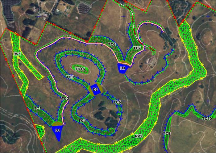
I'm designing a "Keyline Plan' for a new farm, and find myself longing for other examples of tree/plant/pasture layouts with accompanying topo maps.
Is there a good gallery of plans out there?
Can we start one here?
Post photos, schematics, topo maps of your farm, food forest, and orchards please!
Grant
e.g. these:


