posted 3 years ago
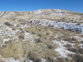
When we moved to my family farm 4 years ago, we took our 76 cultivated acres out of production, letting them go fallow and running sheep through them in a haphazard sort of way. They had been plowed, treated, and rotated between winter wheat and millet/similar for 80 years, and they are hard, dead, and sad. Gullies formed unchecked decade after decade, causing catastrophic wash in our surrounding woodland. There has been apparently no consideration for contour or soil retention since my great-grandfather passed in the 70's.
As our first major proactive reclamation/remediation/mitigation action, I'm focusing on our North 40 acres - which is a sort of triangular 27 acre open patch surrounded by woodland, bordered by one of our springs/creek.
I believe my first step will need to be some earthworks. Contouring some retention swales, and perhaps building a pond or two at the exit point on the southern tip of the field.
After that, I'd like to develop a coppice/pollard silvopasture for food, fodder, building, craft, and firewood. Currently the plane is to be able to periodically run sheep/goats/pigs through contoured alleys.
Trees I'm considering, and for what purpose:
black locust - n fixer, fodder, food, building, firewood
hazelnut - nut, fodder
mulberry - fruit, fodder, craft, firewood
slippery elm - medicinal cash crop
elderberry - medicinal cash crop, craft
other bits and bobs for diversity etc.
Current rough plan is:
1) site survey: detailed contours, headcut remediation plan
2) earthworks: swales, pond installation, stream work
3) seeding tree rows
4) tending the trees, running animals
Some questions I have:
1) For the initial earthworks, is my best bet to go through our local extension? Are there other alternatives, short of forking over the coin to have someone come out with heavy equipment?
2) I'm thinking of running my tree lines on the downhill base of each countoured swale, to take advantage of the water lens that forms downhill from catchment. Good idea?
3) I'm a bit torn between running irrigation to get bare-root tree rows started, vs overseeding, skipping the irrigation, and letting them fend for themselves, come what may.
Some other notes:
- zone 7, 27.41in average annual rainfall.
- Deer pressure is heavy.
- The gully at the main water exit is pretty catastrophic as mentioned, with a 10 foot headcut advancing upstream with every heavy rain. This is where I'm considering building a pond, or series of ponds. Still researching the best ways to go about this. I'm thinking of renting an excavator for a week to do the earthworks, model it after Sepp Holzer, and run pigs in it for a season to help seal. Additional suggestions very welcome.
- The North border is lined with *very* intense and obtrusive power lines from the wind energy fields nearby. You can hear them from 100 feet away. Walking too close vibrates your whole body. Instant migraine for me. So I'm thinking of a long berm at that border and letting the wood edge expand to 100 feet of evergreen as buffer. We have copious amounts of juniperous virginiana, which does well, but I'd like to bring back some pine, which has a history here but is scarce at present.
- I had a great convo with Mike Gaglio looking at the water habits and erosion problems. If I don't go the pond route, he recommended using some of our excess dead Juniperous virginiana overgrowth to build a log stepdown ala Bill Zeedyk and Van Clothier. I think this is doable, but how long will it last? Will it cause a larger problem when it fails in 50-80 years after I'm gone? Then, I guess you run the same problems with ponds.
My finest elevation map is 10ft, which is not very useful as the north-to-south fall is less than 20 feet total. What's the most practical way to get more detailed contour info for layout out swales? I'm open to getting some gear and learning simple surveying, or hiring GIS services if it is worth it.
- long term plan includes a simple, off-grid hospitality structure or two at the Northern edge.
- I'm modeling the development ethos after Lab Protocol at Wheaton Labs, meaning I'm aiming for as close to zero plastic, limited petrol us after initial terraform, and strict limitation on inputs.
Topo and countour images attached.
If anyone has gone this path before, I am aware I have a lot to learn, and I welcome insights, questions, thoughts, suggestions!
north-fourty-countour.png
![Filename: north-fourty-countour.png
Description: [Thumbnail for north-fourty-countour.png]](/t/205333/a/195968/north-fourty-countour.png)
north-fourty-topo.png
![Filename: north-fourty-topo.png
Description: [Thumbnail for north-fourty-topo.png]](/t/205333/a/195969/north-fourty-topo.png)


