• Post Reply Bookmark Topic Watch Topic
  • New Topic
permaculture forums growies critters building homesteading energy monies kitchen purity ungarbage community wilderness fiber arts art permaculture artisans regional education skip experiences global resources cider press projects digital market permies.com pie forums private forums all forums
this forum made possible by our volunteer staff, including ...
master stewards:
  • Carla Burke
  • Nancy Reading
  • John F Dean
  • r ransom
  • Jay Angler
  • Timothy Norton
stewards:
  • paul wheaton
  • Pearl Sutton
  • Tereza Okava
master gardeners:
  • Christopher Weeks
  • M Ljin
gardeners:
  • thomas rubino
  • Jeremy VanGelder
  • Megan Palmer

Fun with the climate map

 
master gardener
Posts: 2138
Location: Zone 5
1170
ancestral skills forest garden foraging composting toilet fiber arts bike medical herbs seed writing ungarbage
  • Likes 4
  • Mark post as helpful
  • send pies
    Number of slices to send:
    Optional 'thank-you' note:
  • Quote
  • Report post to moderator
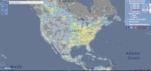
I’ve been playing around with the precipitation option on this world climate map:

https://openclimatemap.org/?variable=PRECIPITATION&resolution=5m&difference=true&month=4&yearRange=1970-2000&lat=43.209680&lon=-72.990417&zoom=10

I notice something. Areas that are mostly farmland around here have between a little less than 3, and 3.5in of precipitation monthly. Whereas in areas that are more deeply forested, precipitation goes up from 3.7 at the forest edge, to over 4in deep into the wilderness.

This is an area that would naturally be 98% forest if it were allowed to regrow.

They said it right, trees make water, not the other way around!
 
I agree. Here's the link: http://stoves2.com
reply
    Bookmark Topic Watch Topic
  • New Topic