|

|
|
|
|

|

|

|

|

|


![[Thumbnail for turkey1b.jpg]](/t/58121/a/43148/turkey1b.jpg "Filename: turkey1b.jpg
Description:")
 1
1
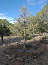
Pete Casanova wrote:Ryan, I just tried to do a homestead thing. I crashed and burned for various and Sundry reasons. I think I'm tough enough to try again and I would really love to do it on a piece of ground next to someone else who is of like mind. I'm older than dirt but very healthy and I am hoping that this ground that you were talking about has no dirt bikes. on my piece of ground I have built solar panels by soldering together solar cells and I dug a hole 22 feet deep hoping to hit water with a post hole digger. I build rammed-earth walls out of discarded tires. I would like to know more about you and would like to let you know more about me. My wife wants me to let you know she is an artist and we love peace and quiet. one of the things I did on my piece of ground was create ponds with tarps and I was able to collect water from the rain. and yes we hauled our water and know how to conserve.
[/quo
Its a big area. Just talked an inspector today seems some people are building without permits, I get the impression the drawback is it you want to sell the property. The county is lad back it seems.
Kirk Schonfeldt wrote:New Mexico AES released a cultivar of Trebizond Date 'King Red' some decades ago that would be worth locating. Also, look for Carpathian Walnut 'Mesa' which was released in NM and is more adapted to high desert sun than most cultivars. And, as I recall, Eleagnus sp. are resistant to the allelopathic chemicals walnuts produce (and fix N).
LT Trucker, AK

|
Are you here to take over the surface world? Because this tiny ad will stop you!
Contemplate spending the next 20 years puttering in permaculture projects
https://wheaton-labs.com/bootcamp
|