• Post Reply Bookmark Topic Watch Topic
  • New Topic
permaculture forums growies critters building homesteading energy monies kitchen purity ungarbage community wilderness fiber arts art permaculture artisans regional education skip experiences global resources cider press projects digital market permies.com pie forums private forums all forums
this forum made possible by our volunteer staff, including ...
master stewards:
  • Carla Burke
  • Nancy Reading
  • John F Dean
  • r ranson
  • Jay Angler
  • paul wheaton
stewards:
  • Pearl Sutton
  • Leigh Tate
  • Devaka Cooray
master gardeners:
  • Christopher Weeks
  • Timothy Norton
gardeners:
  • thomas rubino
  • Matt McSpadden
  • Jeremy VanGelder

Computational permaculture

 
Posts: 4
Location: Minnesota
  • Mark post as helpful
  • send pies
    Number of slices to send:
    Optional 'thank-you' note:
  • Quote
  • Report post to moderator
For what reason are you planning on surveying? I'm sorry, I may have missed the context for your post on surveying.
 
Posts: 489
Location: Dawson Creek, BC, Canada
45
  • Mark post as helpful
  • send pies
    Number of slices to send:
    Optional 'thank-you' note:
  • Quote
  • Report post to moderator
I have a few reasons:
1. build a more accurate model (DEM or similar) of the land elevation as a function of position, so as to derive contour lines, find keylines and similar.
2. determine positions of dugout boundaries at various states of fill.
3. determine positions of posts, poles and trees.
4. other stuff.

I have a handheld GPS, but it simply has to imprecise data to be more than a help with things.  In order to keep the water in my body from absorbing satellite signals, I usually tape my GPS onto a baseball hat, and wear it on my head.  This also tends to keep the GPS in a constant (almost horizontal) plane, and oriented along the track (if I don't move my head around).

I plan to put GPS and a depth sounder on a RC boat, so having boundaries at various fills will help with making a model (inverse DEM) of the depth of the dugout.

If I have a picture from one orientation where I cannot see where a tree becomes part of the surface, and another where I can see where the tree joins the surface, I may be able to derive elevation data for where the tree joins the surface.  Most of my land has a 7-10% north facing slope.  A corner of my land has a steeper east facing slope.

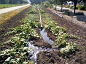
Managing how frost flows across the landscape is needed, especially at harvest time.
 
Gordon Haverland
Posts: 489
Location: Dawson Creek, BC, Canada
45
  • Mark post as helpful
  • send pies
    Number of slices to send:
    Optional 'thank-you' note:
  • Quote
  • Report post to moderator
Unrelated (to cameras on a tethered balloon, fixed wing UAV or drone UAV).

Can a person "generalize" phased array ultrasound to the production of sound fields meant to dissuade deer?  The idea being is that if a deer is detected (motion detector of some kind) in some direction at some range, can a person ave emitted sub-audible sounds from many directions in the vicinity, that all come "in phase" in the vicinity of the deer?
 
Andy Brown
Posts: 4
Location: Minnesota
  • Mark post as helpful
  • send pies
    Number of slices to send:
    Optional 'thank-you' note:
  • Quote
  • Report post to moderator
How far is the nearest airport? It doesn't look like Canada's UAV regulations are too harsh. If you could get a small drone then you could pretty easily create a DEM of your land. I think that would be the easiest option, the balloon idea could work but it would be a lot tougher to get consistent photos.
 
Gordon Haverland
Posts: 489
Location: Dawson Creek, BC, Canada
45
  • Mark post as helpful
  • send pies
    Number of slices to send:
    Optional 'thank-you' note:
  • Quote
  • Report post to moderator
Even the furthest point on my farm from the airport, is within restricted airspace.

I have no problem with a tethered balloon.  The robot on the ground will know where it is (GPS), the balloon will know where it is.  I hope to set up a GPS base station and do real time kinematic, so I should be able to get to 10cm or less.

Now, if my neighbours want access to the RTK information, that might be something else.
 
Andy Brown
Posts: 4
Location: Minnesota
  • Mark post as helpful
  • send pies
    Number of slices to send:
    Optional 'thank-you' note:
  • Quote
  • Report post to moderator
I see, that's a bummer!
 
Posts: 67
Location: Smithers, BC
20
6
kids dog forest garden gear foraging books earthworks pig rocket stoves wood heat ungarbage
  • Mark post as helpful
  • send pies
    Number of slices to send:
    Optional 'thank-you' note:
  • Quote
  • Report post to moderator
Hi Gordon, I live in McBride (54 ish), we use spot weather a lot:

https://spotwx.com/

You can pick from a number of different models, they all have their strengths and weaknesses. The NAM seems to be the most accurate for precipitation. Winds are consistently under called, but the directions are usually within about 60 degrees. I like spot because the graphical format really works well with my brain. There is another resource you might like that is a bit more graphical but still allows for model comparison:

https://www.windytv.com/

And finally Avalanche Canada issues a Mountain Weather Forecast throughout the entire year that is quite good for a general idea of what to expect throughout the province over the next week:

https://www.avalanche.ca/weather/forecast
 
Why am I so drawn to cherry pie? I can't seem to stop. Save me tiny ad!
turnkey permaculture paradise for zero monies
https://permies.com/t/267198/turnkey-permaculture-paradise-monies
reply
    Bookmark Topic Watch Topic
  • New Topic