• Post Reply Bookmark Topic Watch Topic
  • New Topic
permaculture forums growies critters building homesteading energy monies kitchen purity ungarbage community wilderness fiber arts art permaculture artisans regional education skip experiences global resources cider press projects digital market permies.com pie forums private forums all forums
this forum made possible by our volunteer staff, including ...
master stewards:
  • Carla Burke
  • Nancy Reading
  • John F Dean
  • r ranson
  • Jay Angler
  • paul wheaton
stewards:
  • Pearl Sutton
  • Leigh Tate
  • Devaka Cooray
master gardeners:
  • Christopher Weeks
  • Timothy Norton
gardeners:
  • thomas rubino
  • Matt McSpadden
  • Jeremy VanGelder

High efficiency farming?!

 
Posts: 489
Location: Dawson Creek, BC, Canada
45
  • Likes 2
  • Mark post as helpful
  • send pies
    Number of slices to send:
    Optional 'thank-you' note:
  • Quote
  • Report post to moderator
I am going to try something with hedges.  So, part of my research goes back to the osage-orange hedges on the Great Plains.  According to learned people, the reason the O-O hedge is no longer used, is that barbed wire cheaper.  But to look into "high efficiency" farming, that outer 20 feet or so of a field being hedge, and not "useful soil" eats into profits.

Just how does a hedge that takes up the outer 20 feet of a field, affect things?  People talk about pleating O-O hedge, and perhaps some people did.  I think most O-O hedge was just palisade trees because those thorns are awful to deal with.

Assuming square fields, and that the shielding effect of trees is 7 times height, and our hedge height is 20 feet.
- a 1 acre field is about 209 feet on a side.  We lose 34.7% to hedge, but our field is 82.8% sheltered from the wind.
- a 10 acre field is 660 feet on a side.  We lose 11.8% to hedge, but our field is 22.6% sheltered.
- a 40 acre field is 1320 feet on a side.  We lose 6% to hedge, and we are 10.9% sheltered.
- a 100 acre field is 2087 feet on a side.  We lose 3.8% to hedge and we are 6.8% sheltered.
- a 160 acre field is 2640 feet on a side.  We lose 3% to hedge and we are 5% sheltered.

A 160 acre field is also known as a "quarter section", which is half mile by half mile.  I think for people "serious" about farming (at least in this part of the world), you need at least 1 quarter (section).  I don't know what the distribution of field sizes looked like when barbed wire came on the scene.  Just for argument's sake, I am going to assume 160 acres.

There are lots of farms using center pivot irrigation, which irrigates about 78.5% of the field (you can  push water further "out", but this requires a smart system so that one pushes water further out based on the position of the irrigation equipment).  So let's assume stupid center pivot irrigation at 78.5%.  
Barb Wire Salesman: if you cut down that hedge and plant it  to productive crop, you will make so much more money, you will be rich in no time.

That hedge is only taking 3% of the field.  I think 3% is well within the natural variation of yield for a crop on a 160 acre field, even today.

Yes, we are assuming the hedge is 20 foot tall, so shadows will be cast on the crop, and some of the crop will have reduced daylight hours.  An affect of windbreaks can be to elevate ground level carbon dioxide.  In the past, this was a factor which led to increased production.  With climate change, it may lead to increased production.  There are studies which show increased carbon dioxide can lead to changes to nutrients in the product (hay, grain, ...).  Not necessarily changes one wants.

I live in a windy place.  I planted 76 corn plants (started in pots), and even though I planted in a semi-sheltered location, I think I lost most of the corn to the wind (and the growing season is just starting).  Having a windbreak shields some of the field from direct wind effects.  A common effect for farming, is "lodging".  The crop has been knocked down to the ground by the wind.  But, in a quarter section field, I can expect about 140 feet of the 2640 foot width to be protected from wind affects.  We lost 3% to having the hedge there, and it shields about 6% of the crop (at a 20 foot height).  In a wide open prairie (which is what the people here seem to want), to have all the crop lodged means no harvest.  Harvesting 6% may give you enough seed for next year.

What else does wind effect?  It can cause pollen to drift.  It can make it difficult for pollinators to do their job.  In some crops, decreased winds has been shown to increase yields.

If a person is going to grow crops like special varieties of corn, looking at the 1 acre field is useful.  Essentially the entire field is shielded from the wind (a slight increase in hedge height would easily make it 100% mathematically).  You could grow different kinds of corn in adjoining fields.

Let's look briefly at center pivot irrigation on a 10 acre field (660 feet on an side).    The center pivot reaches the edge of the field at the half way points.  But in the corners, it comes short (with a stupid irrigation system).  To get to the corners, is to send water at least another 20% further.  On our 10 acre example, that is about 137 feet.  A person can set up a substantial windbreak given 137 feet of space.  Not all corners are the same, so you have different requirements for windbreak based on your prevailing winds.  If we have much more than 10 acres available, and are setting up an array of 10 acre fields, we can orient them so that we get the most wind shielding.


I don't think the farmers gave up osage-orange as a hedge for economic reasons.  I think barbed wire is a convenient excuse.  If the only animals that affect your livelihood are domesticated horses, cows, sheep, pigs, goats and so on, there may be a barbed wire fence in your future.  If other kinds of animals (such as deer, moose, elk, buffalo, ...) are in your area; the standard 5 foot tall barbed wire fence (or a 5 foot board fence) is not going to help you.  Some species of "deer" (which includes moose and elk) can jump more than 10 feet.  I believe 14 foot is the limit.

Robotics may allow for osage-orange hedge to become more viable.  If honey locust is possible, or a replacement for O-O; robotics may allow for the thorned variety of honey locust to be used (much larger thorns than O-O).

-----

For the fields sizes that were around when barbed wire came on the scene, the reason to switch to barbed wire has nothing to do with increased profits for farmers.  It is just salespersonship.   If the only thing challenging your fence is the neighbour's cow, a 5 foot barbed wire fence may be reasonable.  If you have "deer" problems, a 5 foot barbd wire fence is just a minor anoyance to them.  You need something else.

As near as I can tell, the arguments for getting rid  (or never establishing) windbreaks on field edges are just more "fairy dust" from salespeople.

You want the windbreaks.  How wide and how tall governs what you should try for.  And there are no end of articles about pollinators and windbreaks.  More bees means more happiness.  I'm not sure about more wasps.
 
author & steward
Posts: 7159
Location: Cache Valley, zone 4b, Irrigated, 9" rain in badlands.
3350
  • Mark post as helpful
  • send pies
    Number of slices to send:
    Optional 'thank-you' note:
  • Quote
  • Report post to moderator
I have a number of "no planting zones" in my fields. A few of them are associated with rocky soil, but for the most part, if I abandon parts of my fields, it is due to trees (outside the field) out-competing my crops. When I'm evaluating a new field, I won't choose to use a field surrounded by trees. I'd much rather have a barbed wire fence as a neighbor than a hedge. Cause I know that the hedge will be detrimental to my crops.

There might be reasons to grow in a field with hedges or trees, but productivity isn't one of them.

I love my food forests. I don't try to use them for growing annual vegetables.
 
Gordon Haverland
Posts: 489
Location: Dawson Creek, BC, Canada
45
  • Likes 1
  • Mark post as helpful
  • send pies
    Number of slices to send:
    Optional 'thank-you' note:
  • Quote
  • Report post to moderator
Interesting!

Do you have more support on this?

Does it depend on the pollinators you have?

-----

I just came back here (not knowing of Joseph's comment), to talk about frost.  If your land is sheltered, frost will "flow" just like water across a landscape.  If you have a windbreak which is not parallel to how "frost" will flow down the landscape, it will influence how frost flows downhill.  Where something (windbreak, swale, ...) is perpendicular to how the frost wants to flow, it will  stop frost from flowing, and those locations will be more susceptible to frost damage.

 
Joseph Lofthouse
author & steward
Posts: 7159
Location: Cache Valley, zone 4b, Irrigated, 9" rain in badlands.
3350
  • Likes 2
  • Mark post as helpful
  • send pies
    Number of slices to send:
    Optional 'thank-you' note:
  • Quote
  • Report post to moderator
Here's an example in my squash field. The row on the right is 8 feet closer to the trees than the row on the left. In the further away row, the plants are approximately twice as large. It is not dependent on pollinators. The trees are on the north side of the field, so not casting much shade. In the vicinity of the trees, I didn't bother to plant the right hand row this year.


pollinator
Posts: 4958
1195
transportation duck trees rabbit tiny house chicken earthworks building woodworking
  • Likes 1
  • Mark post as helpful
  • send pies
    Number of slices to send:
    Optional 'thank-you' note:
  • Quote
  • Report post to moderator
My experience here in Maine does not back up what you are claiming at all.

In fact, when I took over the farm in 2008, one of my first challenges was to take back the "margins" of my fields. Just to be clear, here we call the space around the outside edge of a field, "a margin". For instance it might be from the first row of corn to the trees...that space is a margin. In just one field I had 50 feet from the first row of corn, to the rockwall. Since that one field was exactly 1 mile around it, if you do the calculations, you will see that unto itself I was losing 7 acres in just one field! I still paid taxes on it, but I sure was not making any money on it...and that was just 1 field. Now start adding up all the other fields!!

Another place I noted your calculations were off, was your calculations on tree height. That is NOT where the problem comes into play. The problem with having trees adjacent to fields is having the LIMBS hang out into the field. Because of the light, not only do limbs grow quickly, they really reach far out. This causes several problems, not only addional shading of the crops, but also smashing windows of tractors. Since farmers hate that (and all tractors today just about have glass cabs), they steer awy from those limbs. As they creep more and more away from the trees, the saplings take over. Now more trees are growing, and the tractors shift over even more!

Then add a tree or limb that falls down, and suddenly there is an obsticle to drive around. With haying or row crop equipment, the farmer is not poised to deal with that, so again, they drive around it. Again, the field has even more margin width to it. Sometime I have to take a photo of this, but 20 years ago this happened, a farmer did not clear the rotted tree that fell over, and in this perfectly rectangular field now, there is a bump that sticks out a good 50 feet into the field where for the last 20 years farmers have driven out around that one log. All they had to do was move that one log and tons of turning would have been eleminated over the years.

It is easy to get caught up in the idea that things are done out of laziness and salemanship, but that is not the case most of the time. When I have questions regarding farm theory, I weigh it against my own experience, and then look back upon history and see what my ancestors have done. In this case, both my Indian Heritage and European heritage cleared land to make room for crops. Surprisingly, it was the Indian side of my family that was more aggressive in this manner. I have records that my European family grew crops amoung the trees, but my Indian side, not used to having limits on land ownership, they used draught and fire to clear land on a vast scale.

Today, I agressively manage my margins by bushogging, smoothing the margins with a bulldozer, and knocking down overhanging limbs with an excavator. But this is the most heavily forested state in the nation granted. Some great stuff happens at the margins, but I have plenty of land that provides that habitat elsewhere on my land, so my fields are fields, and my forest is forest.


Gordon Haverland
Posts: 489
Location: Dawson Creek, BC, Canada
45
  • Likes 1
  • Mark post as helpful
  • send pies
    Number of slices to send:
    Optional 'thank-you' note:
  • Quote
  • Report post to moderator
For Joseph, I would imagine that the trees in question have significant shallow roots?  Hence the competition.

In researching sugar maple, some sources said that in times of stress, sugar maples would bring up water from deep from the taproots, and then distribute some of that water to the surface region via surface roots (and use the rest for itself).  I've only got two sugar maples, and they are only 1 foot tall, so it will be a while before I will be able to observe anything here.

----

I tried to check my calculations as I went along.  I was assuming that the hedge was "square", that the spread of branches to either side was equal to the height.  A hedge that was composed of conifers is probably undersquare (taller than wide).  Very few trees seem to be oversquare.

I agree that everything should pay for itself, but I don't think that means not having treed margins.  I think the margin is a good place for flowering trees, for berries and maybe herbs.  At the moment, the only equipment I have is a 27hp lawn mower (6 foot deck).  No glass.  Everything else gets done by foot.  As there is 80m (260 feet) of elevation difference on my farm, I am getting lots of exercise walking up and down hill.  I am hoping to get a 35-50hp tractor, among other things with a chipper/shredder to deal with broken branches.

I am hoping that I will be able to prune branches at something like 15 foot above the ground, so that the lawn mower or small tractor can get under some of the larger canopy trees (but not conifers).

I have no answer for someone who can't visit the field occasionally to remove fallen trees or deal with broken limbs.  I had heard of a farmer (in Alaska) who had a single big tree in the middle of an 8 section field.  The biggest field my family had (when I was in university) was 1500 acres.
 
Travis Johnson
pollinator
Posts: 4958
1195
transportation duck trees rabbit tiny house chicken earthworks building woodworking
  • Mark post as helpful
  • send pies
    Number of slices to send:
    Optional 'thank-you' note:
  • Quote
  • Report post to moderator

Gordon Haverland wrote:I think the margin is a good place for flowering trees, for berries and maybe herbs.


Perhaps.

I have a few other places that already have that (such as apple trees, peach trees, and whatnot), but I do have an area I would like to put into low bush blueberries. (High bush blueberries do not do well here for some reason). It is on a particular margin that would be ideal for it. being on the uppermost part of one of my fields, it has exposed ledge rock in places, perfect for lowbush blueberries to get established and spread. The wood growing there is not much good for anything, even firewood is out as the wood is so short due to the high winds, and the limbs that stick out are ferocious because of the field drawing them. I thought about mowing that down with a mulcher and then planting the lowbush blueberries on that. What thin soil here is really fertile, just thin and acidic; perfect for blueberries.

Another margin I have could grow cranberries, but it would be a HUGE investment because I would have to build cranberry ponds to do it. It is quite wet though.

It all depends. On a specific farm, sure hedges might be better than wire, but perhaps on others, it would not. It would not be on my farm. The land base here is only 10% field and 90% forest, so it is a constant battle to beat the trees back, not plant them! Geerally the Permiculture Way is to work with what you have, not introduce something and then spend all your time trying to fight it.
 
Gordon Haverland
Posts: 489
Location: Dawson Creek, BC, Canada
45
  • Mark post as helpful
  • send pies
    Number of slices to send:
    Optional 'thank-you' note:
  • Quote
  • Report post to moderator
I live about 5 miles downwind of a 130+ MW wind farm, so we get a fair amount of wind as well.  There are some places where trees get severely stunted by wind, but I think the most common tree here is aspen (colony plant).  Where aspen were in the past, they could sneak back in again.  The biggest problem I see with aspen, is a stand of aspen 1 row wide will not survive the wind.  You probably need something like 50 feet of aspen to successfully survive.  Lots of land owners thin the aspen too much, and then lose what is left.

I think the eastern slopes of the Rockies in Wyoming and Colorado see stronger winds than I do.

Most of my land is a north facing slope, but there is a section which is east facing and I suspect pockets of soil mixed in with boulders or possibly ledge.  I was thinking terracing at some point.  But your situation sounds more exposed than this is here.

I never looked at how one develops a windbreak where the winds are so strong to begin with.

I don't think cranberries would every work here, we don't get enough rain (I think long term average is 19 inches per year).  Pretty much every August is drought, leading into winter.  Autumn usually lasts about 10-14 days.
 
Posts: 158
Location: Prairie Canada zone 2/3
70
  • Likes 1
  • Mark post as helpful
  • send pies
    Number of slices to send:
    Optional 'thank-you' note:
  • Quote
  • Report post to moderator

Gordon Haverland wrote:

I never looked at how one develops a windbreak where the winds are so strong to begin with.


We protect small trees with snow fence or piled brush to break the wind, at least for the first few years.  So far, so good.
 
Gordon Haverland
Posts: 489
Location: Dawson Creek, BC, Canada
45
  • Mark post as helpful
  • send pies
    Number of slices to send:
    Optional 'thank-you' note:
  • Quote
  • Report post to moderator
I was just out weeding, and had an idea.

If trees need assistance because it is so windy, perhaps one plants a vine on a scaffold strong enough to withstand the wind?  Perhaps with deflectors to reduce how much wind load the leaves see?

---

I had run across a report out of Scotland that piles of dead trees, branches, ... worked well for protecting young trees from deer.  It makes sense they work for wind as well.

 
Gordon Haverland
Posts: 489
Location: Dawson Creek, BC, Canada
45
  • Mark post as helpful
  • send pies
    Number of slices to send:
    Optional 'thank-you' note:
  • Quote
  • Report post to moderator
Is there an error?

Let's take 1 acre.  It is 208.7 feet on a side (if square).  The fraction occupied by hedge is:
1 - (208.7-2*20)^2 / 208.7^2
which is the 34.7% number I produced.

How much is sheltered?
It is a 20 foot tall hedge, so we are assuming 140 feet is sheltered.  We are talking about sheltering crop, so it is 140/(208.7-2*20), which is the 83% number I had.

The problem is that some of that sheltered area, is hedge.
Our sheltered area is 140*(208.7-40).  The total area is 208.7^2.  That ratio is 54.2%.

The idea behind sheltering, is that what is being sheltered, sees benefits.  So a question I will ask, is there some benefit to the hedge, if it is sheltered by the hedge?  I suspect the answer to that is species specific.  Self-sheltering of nitrogen fixing hedge species might result in more fixing of nitrogen.

If we didn't have hedges, we might see depressed yields of something like 3% due to wind damage (ignoring wind effects like lodging), and then we have other effects like increased evaporation.  So maybe we call it 6%?
208.7^2 * 0.94 = 40942 (and ignoring fractional square feet)

With our 20 foot hedge, we will guess that we have 100% on the sheltered area and 94% on what isn't sheltered (there should be a transition, not a sharp change).
0.542*(208.7-40)^2+0.94*(1-0.542)*(208.7-40)^2 = 27678

So our 1 acre field which has only 0.542 acres of plantable area, is producing a yield expected for 0.676 acres (with no windbreak).  That is an overproduction ratio of 1.25.  (Or maybe I made a calculation error again?)

Some fraction of the 34.7% of the land that is taken by the hedge, can be used for other crops.  Crops like berries.  And it is possible that for the 8 different "buffer" regions, you might have 4 different "best use" crops.

Yes, we are only producing 67.6% of the crop if we mono-cropped the entire 1 acre.  But almost 45% of that land can be producing potentially 4 different crops for the farm.  The hedge itself takes up some ground, so maybe you say that 30% of the land can be used for other crops.

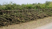
What does our 20 foot tall, 20 foot wide hedge buy us?
* We now have a buffer of 20 feet from any of our neighbours, to stop things like diseases from getting to our crop.
* Wind born problems (pollen?)
* Our margin crops, are growing under a canopy.  They are partially protected from things like hail and lodging.
* We could choose to just grow a ground cover crop, such as clover.  It could be a nitrogen fixer or an accumulator.  It could be providing nutrients to the 54.2% crop that is our main effort.  Which means we might not need as much fertilizer (or we could see increased yields near the border).

An article from Australia (about living fences, has good descriptions on many of the effects of windbreaks - http://www.rainforestinfo.org.au/good_wood/livng_fs.htm ).

I did GPS/GIS work for Alberta Agriculture.  We had projects all over Alberta, including places which suffered thgrough the dustbowl era.

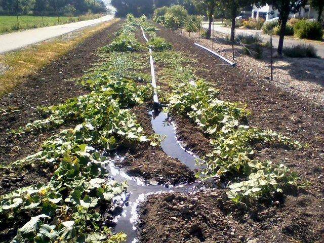
If we were to fertilize a field in strips, with spaces in between that are not fertilized and we were to monitor grain yield in the combine driving perpendicular to these strips, we would see changes in yield, but these changes would not be step changes (but the fertilizer application is (almost)).  And the changes would be offset from where the grain was grown (best seen by varying the width of the non-fertilized areas).

How one has to unmangle this, is something called deconvolution.  In fields and crops I was looking at (for a particular kind of combine), the "delay" between hitting a change in crop properties, and some change in yield on the combine was about 25 seconds.

Anyway, when a person (approximately) deconvolved the yield data (trying to assign the yield not to the location where the combine was when the grain passed the yield sensor, but rather to the location on the field where the grain came from), you could see the presence of former barbed wire fences across some of the fields.  Even though barbed wire does not present a large barrier to wind, old fencelines had higher productivity due to trapping some of the soil blown off the land in the dust bowl era.

We don't use small fields for farming in North America, but they are useful for special purposes such as growing single species corn.  But there are places in the world where the average farm is around 2 acres.  If we choose to use the under canopy area of border hedges, we could produce 5 crops from a field instead of 1.  Which leaves us much less susceptible to crop losses due to disease or weather (not all eggs in one basket).

Let's throw one out there.  On the south side of a south hedge, we enclose the side from the canopy to ground level and inside (under the canopy) we have a vertical array of tomato plants.  Little or no wind, controlled evaporation losses, no wind blown disease or pests, captive bees for pollinating, and so on.  How many tomatoes can a greenhouse grow in (208.7)*(20/3)*15= 20,870 cubic feet?
 
Gordon Haverland
Posts: 489
Location: Dawson Creek, BC, Canada
45
  • Mark post as helpful
  • send pies
    Number of slices to send:
    Optional 'thank-you' note:
  • Quote
  • Report post to moderator
High Efficiency Farming - Part 1.5

This is just handwaving.  If some CFD person wants to calculate this, that would be wonderful.  If you could tell me how to generate the same results in some Open Source manner, that would be better.

But for wind to approach a windbreak, it makes an upper transition at some point.  The height of the windbreak influences how high the streamflows have to be diverted, before they start coming back down to the surface.  So there are two transitions to the streamflow, the leading one and the trailing one.

The winds at ground level are nominally attached to the boundary layer of the surface, and have the smallest velocities, these winds will  stay parallel to the surface longer than higher level winds, and make the sharpest ascent.

Attached to this note, is a too simplistic handwaving at streamlines.  A real streamline  will get pushed upwards, and then at some point start coming back towards the ground.  I am ignoring the come back to ground level part.  I am using the arctangent function to do my handwaving.  I suspect the error function might have closer affiliations to a true answer, but arctangent is easier to calculate.  I am using Gnuplot to generate the graphics, and it explicitly shows the functions plotted.  Don't pay attention to the values for various things, this is just handwaving.  I adjusted coefficients to do things that needed to be done, or were convenient.

The streamline from ground level starts to come off the ground at about twice the height of the windbreak.  It just hits the top of the windbreak, and then continues upwards to eventually hit about twice the height of the windbreak.

The streamline which originates at the height of the windbreak, starts to divert upwards earlier than the groundlevel streamline.  And it takes longer to come to its maximum level on the leeward side of the windbreak.

Where the distance between the two streamlines is reduced, wind velocity will probably be higher.  So there is a "pinch point" in the vicinity of the windbreak.

Apparently the maximum height of the upwards motion of the streamlines, is at 3 to 5 windbreak heights downwind.  As I am not putting in any math to fudge this, you have to look to your imagination.  Is there a "peak" at 3-5 on the downwind side?


In reading descriptions on windbreaks, the values foe upwind influence, downwind influence, vertical influence and other things ranges over too large a range for me.  I think all of these influences depend on the windspeed (low winds leading to larger affects), but they may also depend on the height of the windbreak (especially at low wind speeds).

If we go to put up a windbreak, we have to take a guess at what height of windbreak we want.  If we want a 36 foot tall windbreak and what we get is 32 feet tall, we cannot jack up the windbreak by 4 feet.  We have to live with what we got.  Or rather, if your windbreak is composed of trees, you cannot jack it up.

atanWind.png
[Thumbnail for atanWind.png]
Handwaving streamlines for windbreak
 
Travis Johnson
pollinator
Posts: 4958
1195
transportation duck trees rabbit tiny house chicken earthworks building woodworking
  • Likes 1
  • Mark post as helpful
  • send pies
    Number of slices to send:
    Optional 'thank-you' note:
  • Quote
  • Report post to moderator

Gordon Haverland wrote:I have no answer for someone who can't visit the field occasionally to remove fallen trees or deal with broken limbs.


Oh I do!


It is because for the farmer the day starts at 3:30 AM with them knocking some coffee down their throat, a bit of breakfast and in the barn by 4:30 to start getting the cows in to milk. By about 8 AM the cows are fed, milked, and if the milk truck driver does not chat endlessly, or a salesman come to sell corn seed, or a neighbor does not stop in wanting to buy hay, they might get the equipment together to start planting crops, getting crops in, spreading manure. If that is not on the agenda, there might be some veternery issues since there are 1200 milkingcows alone to deal with, much less all the calves and heifers that are not yet milking. Breeding them, checking them, and helping the ones that are sick might also be on the agenda.


If a person is lucky their wife has brought them lunch by noon, though probably something has broke down, had a flat tire, needed fuel, or there was a some agricultural related meeting to attend too. Either way they must get back by 16:00 so they can start the afternoon of milk of the cows. Nothing changes in the routine there, feed, milk, rinse milk lines, etc, and hope all goes well without breaking anything. If it does, it just means you have a longer day because it does not matter what time it is, you are not done until the job is done; there is no end-of-shift on a dairy farm. If a person is lucky they will go to bed about 8:30...maybe 9:00 if they get to spend some time with the wife and kids...


The next day...rinse and repeat. It does not matter if it is just another Tuesday or Christmas, same thing; get up at 3:30 and start your day. Cows have to be milked twice a day, 365 days a year...


It does not let off much in the winter, even if there is no crops to try andplant or harvest. There is no picking up dead fall because there is 2 feet of snow on the ground, and even if there was not, the dead fall would be frozen to the ground after October. Of course what replaces crops to deal with are frozen pipes to the waterers, and snow to push out of the way. Firewood to keep everything warm in the houses, milking parlor, etc.


Oh I can easily see why people do not take the time to go pick up dead fall in a field. It is unfortunate, but I can easily understand why people do  not.
 
Gordon Haverland
Posts: 489
Location: Dawson Creek, BC, Canada
45
  • Mark post as helpful
  • send pies
    Number of slices to send:
    Optional 'thank-you' note:
  • Quote
  • Report post to moderator
I know that people on the farm have worked some long days.

Recent reading about osage-orange hedges, mentioned some farmers pruning 750 feet of osage-orange hedge in one day, with a scythe.  For people not familiar enough with osage-orange, I give you some Janka hardness values for various trees:

Aspen 380
Butternut 490
Poplar 540
Cherry, Maple 950
Walnut 1010
Birch 1260
White Oak 1335
Hard (Sugar?) Maple 1450
Honey Locust 1548
Hickory 1820
Osage-orange 2760

It is too bad that some people have to work that hard, whether it is farming or anything else.  As a young adult, my Mom worked like that.  She once worked a restaurant (waiting tables, clean up and cooking) for 2 weeks straight without any sleep.

To me, that kind of working is to reduce a person to an animal.  One of the things which sets mankind apart from the animals, is the ability to think.

A case in point.  We have so many people in government who grew up with Bambi, making laws and rules allowing deer (all kinds) populations to rise.  With deer being one of the driving forces for changes in biodiversity on the land and in the forests, farmers are uniquely situated to see these changes happening.  But to work a schedule like you mention, there is no time for noticing something like this.
 
gardener
Posts: 1174
Location: Western Washington
332
duck forest garden personal care rabbit bee homestead
  • Likes 2
  • Mark post as helpful
  • send pies
    Number of slices to send:
    Optional 'thank-you' note:
  • Quote
  • Report post to moderator

Joseph Lofthouse wrote:I have a number of "no planting zones" in my fields. A few of them are associated with rocky soil, but for the most part, if I abandon parts of my fields, it is due to trees (outside the field) out-competing my crops. When I'm evaluating a new field, I won't choose to use a field surrounded by trees. I'd much rather have a barbed wire fence as a neighbor than a hedge. Cause I know that the hedge will be detrimental to my crops.

There might be reasons to grow in a field with hedges or trees, but productivity isn't one of them.

I love my food forests. I don't try to use them for growing annual vegetables.


This is an interesting point about growing things in ground in a food forest. I'm experimenting with growing in hugelbeds in the orchard, with good success, though the trees are young. I'm thinking the roots won't reach into the top part and that the soil is so rich anyway that there's plenty to go around. But we'll see how it evolves over time
 
Gordon Haverland
Posts: 489
Location: Dawson Creek, BC, Canada
45
  • Mark post as helpful
  • send pies
    Number of slices to send:
    Optional 'thank-you' note:
  • Quote
  • Report post to moderator
I hope to "soon" have trees with sparse cover (such as honey locust) to look into some of the shadowing issues.

Knowing what is on your land is part of the knowledge we seek.  If we take photographic images fresh out of winter, we can probably pick off items of interest in images which correspond to the ground level.  Hopefully there are other things of interest too.

There are two trains of development here: look down and look horizontally.  In both sets of data, we need to associate a location to the camera when the image was taken.

Look down.  This models itself after aircraft flying parallel courses taking pictures, which are then used to produce maps.  The model most people would take today, is the quadcopter with the camera platform underneath.  I live within the restricted perimeter of an airport, and apparently I have an option; to tether a balloon to a mobile robot on the ground, and take pictures from the balloon.  Raw GPS is typically good to something on the order of 10m horizontal and 20m vertical.  Which if you are tens of meters above the ground; really isn't good enough.  You probably need to set up a GPS base station at your farm; and equip it with what is needed to do at least differential GPS.  It would probably be better to equip it so that you can use real-time kinematic corrections.

I have some of the hardware to do this.  I purchased a RPi clone which was a bit of a hot rod compared to RPi a year or two ago.  It should be more than fast enough to work with a GPS chip from which a person can get timing data from, and the stuff needed for libRTK to work.  A side effect of having a GPS base station, is that you now have a stratum 1 NTP server possible.    So, you would want to update your farm computers to get their time signal from this GPS base station.  The RPi clone can run Linux, which is all I need.

I think a pair (or two pair) of RPi cameras; one with the IR filter still present and one with the IR filter removed would work.  All cameras nominally identical otherwise.  If heat issues are important (such as how frost flows across our land), have a long wave IR camera would probably also be useful.  The RPi cameras are probably megapixel; the long wave IR is nowhere near that.

Look horizontal.  I'm cheap.  I am looking to do this with a camera tripod, a not current smartphone that is _NOT_ on any phone network and has no APPs in it.  At the dollar store, I picked up a stiff and thin serving tray, through which I will drill a hole in the centre to accept the 1/4 inch bolt for the camera tripod.  I picked up a smartphone mount meant to be used with a 1/4 inch camera tripod.  My smartphone is actually a little too small, so I need to use some sponge rubber to keep it mounted more firmly.  On one side of the camera, I will affix (CA glue?  Epoxy?) some kind of mount to accept a reasonably good, military style compass.  This has a bubble level, so that you can level the serving tray platform.  It will also let you  point the camera in specific directions to some degree.  It should be a compass which will let you make allowance for magnetic declination.  In the other side of the camera, is to be a mount for a GPS unit.

The software I plan to use for horizontal imaging, is from France and is called Micmac.  OpenSource.  Runs on Linux (maybe other OS).  Powell (the book on hedges I am working on) points out that one shouldn't put hedges, windbreaks or anything else on a farm; knowing that they will interfere with what the neighbours enjoy.  Part of the reason for me to find how to do this kind of mapping in a horizontal mode, is to satisfy Powell.  It may be that I can adjust some of my western deer hedge/windbreak; to not spoil a neighbour's view.  But, the object of the windbreak is to be tall enough, that for the winds that are from the west that the rest of my farm (which is only 660 feet wide E-W) is sheltered.  The most important part of that, is sheltering my dugout, which is quite exposed to prevailing winds now.

If your farm has a GPS base station, you will start off with much better data.  But how you gather data (taking the pictures) can help.

Put a plumb bob on your tripod.  Where you take pictures, drive a piece of steel (such as a 12 inch common nail, or a 2 foot piece of rebar into the ground.  If you use 12 inch common nails, try to have all the nails extend out of the ground the same amount.  Record what height your camera tripod is above this "monument".  When you come back to take pictures, get your tripod at the same height and as close to perfectly centred  on the monument as you can.  That should get your camera position to something like 1mm precision.

Try to take your pictures at about the same time of day (or times of day, if you visit these locations often enough).  Try to take them with  about the same amount of cloud cover.

Try to take your pictures in the same order.

If you really want precision, calibrate your camera.

Even without a GPS base station on your farm, GPS can be useful.  The Kalman filter built into most GPS receivers now produces results of a kind; that if you were to actually travel X meters horizontal at some bearing B (and waited long enough at both start and stop for your GPS to record those points), the calculated distance from the tracklog recording would be close to X.  And similar for changes in elevation.  When you go to do a photo-survey, turn your GPS on, at a convenient place.  Allow the GPS to find satellites and start doing things well (1 minute?).  Walk a standard path from this start point.  I walk across the driveway to the north side, east until the first frost crack, south across the pavement, west back to the start point.  When you finish your photo-survey, walk those same points.

When you first turn your GPS on, you sort of lock yourself in to some bias vector (X,Y,Z).  It is unlikely that this bias vector is (0,0,0), or for that matter 0 in any location).  As you go through your photo-survey, this bias vector will change.  The bias vector probably will change less towards the end, but nature might conspire to not allow that.  Among other things, it depends on which satellites in the constellation are being used for any particular positioning.  Which can change during your survey.

When you locate your camera tripod using the plumb bob and previous records over a monument, you are making a profound statement to software which can process GPS information.  Walking  a known path before and after doing a photo-survey sends a similar statement.  But, every time you walk the photo-survey points, you should be able to improve the location of your "monument".  And you should be able to go back to previously analyzed (I am talking Micmac) pictures and re-run the analyses with better coordinates, and improve their results.

If you go doing things like this, it  is vitally important that you do _NOT_ change the data that is in tracklogs, or position informatino in EXIV data in pictures.  In some analysis, you look first to a database, to see if the position information is in the database.  If it is not in the database, you read it from the original tracklog, EXIV data in a image or whatever.  And then that data gets put in the database, with a serial number (and explanation).  And at the end of analysis you have an improved location (or think it is improved), you can enter that back into the database with an incremented serial number.

If we do this for a few years, and look at how the coordinates assigned to any given point change with time; we should see that they tend to converge to a point.  The true location.

But, if you live in places where there are earthquakes, landslides or other things; the "true location" can change with time.
 
Travis Johnson
pollinator
Posts: 4958
1195
transportation duck trees rabbit tiny house chicken earthworks building woodworking
  • Mark post as helpful
  • send pies
    Number of slices to send:
    Optional 'thank-you' note:
  • Quote
  • Report post to moderator
After rereading, and thinking about this for a bit, I wonder if your initial calculations were off? No so much in the math, but how much a shelterbelt actually "shelters".

I say that because the wind would not just be deflected with a shelterbelt, it would actually change the nature of the wind itself. It is all true that behind the shelterbelt for x amount of feet the wind would be diminished greatly, BUT even far out in the field where the effects of the wind could be felt again, the wind will have changed. It will be turbulent and "mixed" not straight-on wind as before it hit the shelterbelt. I am not sure what sort of change this would make for growing plants exactly, but it does have significant impacts.

If you look at the trees going up the pass in Franconia New Hampshire a person will see the massive pine trees with limbs only on one side. The "Notch" as it is called, allows the wind to rip up it, and so the limbs only grow on the leeward side of the tree. This happens along shorelines that experience high wind. But how would those trees react if the wind was turbulent, mixed, or rolling if you will?

It would seem like it would be a lot. I mean, "energy can neither be created now destroyed, just changed." And so if that holds true, then the energy in the wind gets converted into mechanical motion when it hits the shelterbelt and moves them to and fro. That would seem to me to absorb A LOT of energy. That would show up as turbulent wind, and that is friction acting upon itself. This is no different then a rifled bullet, versus a rifled bullet in flight; a rifled bullet will have more impact force because it is not losing energy by being unstable in flight.

If it did lessen the severity of the wind on growing plants, then your planted shelterbelts would have a lot more "sheltering" then just what simple math would dictate.

(All this is based upon the assumption of flat land. If it was on a hillside, then a lot of things would change. That is because at some height, straight line wind would be hitting the surface of the field again.
 
pollinator
Posts: 2339
Location: Denmark 57N
598
fungi foraging trees cooking food preservation
  • Mark post as helpful
  • send pies
    Number of slices to send:
    Optional 'thank-you' note:
  • Quote
  • Report post to moderator
I live in a windy area, trees on their own in a field only have leaves on one side and lean over at around 45 degrees.  They never get very big before being blown over by an early storm. I recently moved a few miles and one of the reasons I picked this house was the trees, here we have a 6ft diametar beach tree infront of the house that is straight up to the roof height and only then starts to bend, we have several other large trees that are not totally wind destroyed. and the reason is probably the large windbreaks in the fields up hill.

We have to have windbreaks, but remember as well that a windbreak is not a single row of trees, to work it needs to be several plants thick, small ones slightly bigger bushes, then the trees and then back down again. Otherwise you can cause more issues with turbulence (as travis was commenting on) than you would have had with straight wind.

As to planting near trees, I don't, I leave a good 12ft between the nearest annuals and trees, even things I will plant closer like Rhubarb or horseradish I do so knowing that the yield drops by more than half.  Shade doesn't seem to be such an issue as nutrient competition, shade certainly sets back the harvest but that isn't always a bad thing, in my last house I had a lot of redcurrants growing up to and under an alder, the ones under a large alder produced less ( but acceptably) and were a good week later to ripen than those further away and in the sun.
 
pollinator
Posts: 3847
Location: Marmora, Ontario
593
4
hugelkultur dog forest garden fungi trees rabbit urban wofati cooking bee homestead
  • Mark post as helpful
  • send pies
    Number of slices to send:
    Optional 'thank-you' note:
  • Quote
  • Report post to moderator
I just thought up an answer to the dairy farmer who needs that extra time to move that log out off the field margin; robotic calves.

I'll just let that sink in a second, and maybe decrease the relative ridiculousness of it by mentioning that my first idea was a multilegged spider-monkey-looking milking drone that would sit on the cow's back. I figured that might not go over as well as a milking roomba that closely resembled the young of the species.

Just imagine being able to pasture your dairy herd full-time because the milking equipment goes to wherever the herd is grazing. Imagine also being able to sleep in a bit. I think those dog robots that Boston Dynamics makes could do really well as a platform for mobile milking. Just dye, brand (ouch) or tattoo a QR or barcode for a digital reader to track individual cows and their health based on information taken while the robotic calves do their thing. The robo-calves could send a text or email to you and your vet in emergencies, and keep detailed health records on each cow to take the guesswork out of later diagnoses, and to head off medical issues entirely.

And if you're in an area of high predation, you could add frickin' laser beams to their heads...

-CK
 
Gordon Haverland
Posts: 489
Location: Dawson Creek, BC, Canada
45
  • Mark post as helpful
  • send pies
    Number of slices to send:
    Optional 'thank-you' note:
  • Quote
  • Report post to moderator
I would think a RFID tag would be sufficient for identifying livestock.  As far as harvesting milk in the field, the robot would need refrigeration equipment.

I am in a fairly hilly location, not too far from the eastern slopes of the Rocky Mountains.  In particular, my farm is mostly a north facing slope, with an average grade of about 7%.

In terms of turbulence, the turbulence does eventually damp itself out, becoming heat.  The easy part of turbulence, is to see that the wind is moving a leaf, a twig or branch, or the entire trunk and recognize that internal friction  will produce heat.  But viscous flow in of itself generates heat.

If one has a dense windbreak, like a concrete wall, the wind cannot go through the windbreak, it has to go over.  And soon after it gets over the wall, the vacuum created behind the wall draws the wind back down, making the windbreak not very effective in terms of distance.  The diffuse windbreak generates lots of turbulence within the trees and downwind, reducing the strength of the wind significantly.  The density of the air is still nominally the same, so strong winds aloft that were slightly deflected by the windbreak, have little chance to push downward to re-introduce windspeed to the air behind the windbreak.

I see lots of farms up here, where they farmers looked at the multirow prescriptions for windbreaks, and decided to just put up a single row of spruce.  Inevitably the spruce do not get very tall (often they are shorter than the telephone/power poles).  When you do see the 2 or 3 row spruce windbreaks, you easily notice that they are taller.  They support each other.  The second row helps the first row push the wind up, and the third row helps the two rows in front of it.

I suppose aspen is also a good example of this.  A single row of aspen will fail as a windbreak.  It is only when you have many aspens deep of trees, that they become a windbreak.
 
Gordon Haverland
Posts: 489
Location: Dawson Creek, BC, Canada
45
  • Mark post as helpful
  • send pies
    Number of slices to send:
    Optional 'thank-you' note:
  • Quote
  • Report post to moderator
Talking again about the taking of horizontal pictures; regardless of whether we have corrections from a GPS base station or not.

If we mark every location we take pictures from with a monument, and take the time to properly set up over the monument anytime we take pictures, and we always have the GPS with us and hence our tracklog will show these positions where we take pictures.  If you want to make sure that the tracklog shows this data.  When you have the tripod set up (which takes a while) but have not yet put the GPS at its position next to the camera, take the time to walk say 10 paces away from the tripod and then come back, at an angle that is about perpendicular to the track you took to get to that monument.

On our first trip (which means installing the monuments), we are going to visit N sites.  From those N locations, we can derive a long list of differences in position between points i and j (with i != j).

On the second trip we take to survey the land, we again will get N locations where we stopped to take pictures, and we will again generate a big list of differences in position.

We can calculate the average (X,Y,Z) of position i from trip 1 and trip 2.  We can then take that set of average positions, and augment them with new positions, based on these 2 sets of differences in position.  This will expand our "point cloud" at each location from 2 points to much larger than that.  Analyzing this is harder, because all those difference are doubly correlated with each other.  The are correlation just from the act of subtracting one position from the other.  But they are also correlation through the Kalman filter used by the GPS software.

John Mandel, The Statistical Analysis of Experimental Data, 1964 in his chapter on the fitting of straight lines has a section on working with data sets where the error at point i depends on the error at i-1 (cumulative errors).

If we take the first set of differences, and the average location of point 1 and we generate N-1 positions (2, 3, ...N).  We can do that for all N data points, giving us N(N-1) data points.  We repeat this with the second set of difference for a total of 2N(N-1) points.

There are some ways to process this data which are unusual.  We could now find the median (X,Y,Z) position for each monument.  This estimate is expected to be more robust, than an average.  Another thing we could do, is to calculate a "slope" for each of those lines which connects points at Monument 1 to points at monument 2 (we can choose a rotates coordinate system if that avoids working with 2 different signs of slopes).  We then find the median slope of all those lines (and then unrotate it if we need to).  And this gives us the median "slope" between those 2 monuments (I am not talking slope in terms of rise over run).

And you can imagine what happens when we make our third trip across all N monuments gather pictures.  We could find averages of 3 points, or we could instead use the median of the 3 trips at each monument.  Again, the median will be more robust.

The simple ways most of us are taught to work with data, have us doing little work.  But then to talk about errors we have to assume things like error distributions.  If we choose to generate all this other data, we can draw circles, ellipses or similar which enclose 67%, 90%, or whatever other fraction we want of these point clouds.  We don't have to assume that the errors are from any particular distribution in order to establish boundaries on how good our data is.

I think you can see that we can quickly find ourselves in a position where we don't have enough memory to solve the problem.  But I thought you might like a demonstration of a computation intensive approach to a problem.  One place to look for more information on this type of problem is to look at:
https://en.wikipedia.org/wiki/Theil%E2%80%93Sen_estimator
 
pollinator
Posts: 992
270
5
tiny house food preservation cooking rocket stoves homestead
  • Mark post as helpful
  • send pies
    Number of slices to send:
    Optional 'thank-you' note:
  • Quote
  • Report post to moderator
 
Travis Johnson
pollinator
Posts: 4958
1195
transportation duck trees rabbit tiny house chicken earthworks building woodworking
  • Likes 1
  • Mark post as helpful
  • send pies
    Number of slices to send:
    Optional 'thank-you' note:
  • Quote
  • Report post to moderator
All this wind perspective talk made me think of my Grandparents growing up.

They always laid claim that the winters were colder and far worse in their days as kids then they were "now"...the "now" being in the 1980's.

BUT...that was not the case. We live in Maine which has the distinction of being the most forested state in the nation, so we do not have shelter belts here, as the land base is 90% forest, and 10% fields. In my Grandparents day though, back in the 1920's, it was inverted. Maine was 90% FIELDS and 10% forest. This made a huge difference in terms of wind, and drifting snow.

But a second issue was also at play. Today our telephone poles are creosoted affairs made from lodgepole pine that are some 45 feet high. Back in my grandparents day they used White Cedar poles which are native to Maine and naturally rot resistant. But they were at best 20 feet high.

So with little natural windbreaks, and very short telephone poles, it APPEARED to them the winters were worse because they perceived the snow to be deeper. It was not. The snow drifted more over wires that were half as high in the air.
 
Gordon Haverland
Posts: 489
Location: Dawson Creek, BC, Canada
45
  • Mark post as helpful
  • send pies
    Number of slices to send:
    Optional 'thank-you' note:
  • Quote
  • Report post to moderator
Nice story about Maine.

I couple of weeks ago, BC Hydro sent a contractor out.  It turns out, he was drilling poles and inserting boron "pencils" into the poles  4 pencils per pole.  This is a soluble boron compound, so after N years you uncap the hole and insert a new pencil.

He seemed a slightly academic chap.  He knew that BC Hydro used to use western red cedar for poles (probably about as rot resistant as your eastern cedar).  But today, it costs too much money to use western red cedar for poles.  So, the new poles are cheap and need boron to keep them from rotting.

I think he said that concrete poles didn't work, and they were being removed from service.

I would imagine that concrete poles were designed from a civil engineering point of view.  More than a few years ago, someone asked me to look into how to make "bases" for machining tools (lathes, milling machines, ...) out of concrete.  Concrete has a lot going for it.  But the only people that seem to do R&D are civil engineers.  It could be a memory block.

My back ground is Materials Science (I used to say and Engineering, but engineering has decided that supporting people with learning disabilities such as autism or dyslexia is impossible).  And after a couple of weeks of trying to understand the civil engineering literature, I think I found an approach which would make the "concrete tile" part of my idea as good as it could be.  And that was coupled with how to bond tiles and some physics/math knowledge.  And nothing.  So, it is is still sitting here in my head.

I would make a pole out of circular tiles, and I suspect that concrete poles are a single pour monolithic pole, probably with re-inforcements.  There could be some metallic elements to the "stack", probably stainless steel to cope with concrete being porous.

But, this isn't about making power poles.


In some other thread that I had commented on, or originated; somebody  posted a comment that the world should have stopped advancing when the Amish came along.  And that thread had something to do with Osage-orange trees.  By and large, that tree doesn't seem to make "poles".  But it was used in shipbuilding for a while.  It may be that a small fraction of Osage-orange does produce poles (and should be encouraged to do so).  And such poles will probably last much longer than any other wood in North America.

 
pollinator
Posts: 1782
Location: Victoria BC
317
  • Likes 1
  • Mark post as helpful
  • send pies
    Number of slices to send:
    Optional 'thank-you' note:
  • Quote
  • Report post to moderator
I think there must be a hefty dose of 'it depends' in here somewhere..

There is a big (100ft range) fir at one end of a meadow, on my parents place. Get near 30+ ft branches stretching for sun over the meadow, and not much at all is happening.

But, on my place alder, cottonwood, willow, and crabapple up to perhaps 40ft are elbowing their way into the field edges. There is little in the way of noticable impact, right up to the trunks, except in an area of higher ground, before the ditch starts.

This ditch at the edge of my field runs well into summer, and it's generally wet ground. My parents place is a well-treed but rocky hillside without much to hold moisture...

So in my climate, I am guessing that it depends more on water than light..
 
Travis Johnson
pollinator
Posts: 4958
1195
transportation duck trees rabbit tiny house chicken earthworks building woodworking
  • Mark post as helpful
  • send pies
    Number of slices to send:
    Optional 'thank-you' note:
  • Quote
  • Report post to moderator
There is no question that wind plays havoc on farming, but the real question regarding that is how to deal with it?

My farm is situated high on a hill, and is exposed to prevailing North winds. This messes with what we have for grass mixtures because some of the best nitrogen fixers are not very hardy, and are prone to winter kill. This only occurs when there is little snow cover though. One way to induce more snow cover could be the introduction of shelterbelts, but we generally go in another direction, and that is reducing the less hardy varieties in the mix, and fortify the ones that are hardy. All this depends on the field.

If it is subjected to high winds where the snow will be blown off, and the ground bare for much of the winter; we might plant heavy with other varieties, and only 10% with alfalfa. But in fields that are protected from the wind, and thus are covered with snow, we have fields that are 90% alfalfa.

Either method works...build a shelterbelt to protect the crop, or plant wind resistent varieties.

Because this topic is titled high effeciency farming, and this topic is on a Permiculture forum, I propose the latter is better suited. It eliminates the cost of planting a shelterbelt, and does not have valuable land taken up by a shelterbelt. Permiculturally, it goes along with the notion of planting what is the best fit for the land, and not fighting it all the time.
 
Hang a left on main. Then read this tiny ad:
Switching from electric heat to a rocket mass heater reduces your carbon footprint as much as parking 7 cars
http://woodheat.net
reply
    Bookmark Topic Watch Topic
  • New Topic