|

|

|

|
|

|
|
|
|
|
|
|
|

|

|

|

|

|


Regenerative Design for a Prosperous Future, www.7thGenerationDesign.com | Perennial Plants That Just Don't Give A Sh*t, www.HoneyBadgerNursery.com
"You may never know what results come of your action, but if you do nothing there will be no result”
How Permies.com Works
Be Nice
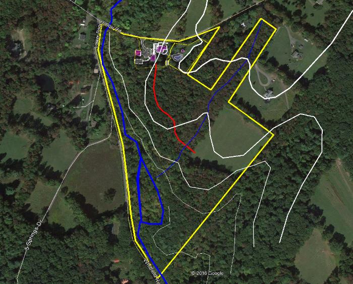
 there is a second pond, where the "S" is in "slope". The overflow from that pond fills the labeled pond in the photo. Both of these are used to fertigate the lavender. However, trying capture some of this road runoff and create some in-soil water storage happen, as we live in a climate with more evaporation than precipitation.
Regenerative Design for a Prosperous Future, www.7thGenerationDesign.com | Perennial Plants That Just Don't Give A Sh*t, www.HoneyBadgerNursery.com
Regenerative Design for a Prosperous Future, www.7thGenerationDesign.com | Perennial Plants That Just Don't Give A Sh*t, www.HoneyBadgerNursery.com
"You may never know what results come of your action, but if you do nothing there will be no result”
How Permies.com Works
Be Nice

|
New rule: no elephants at the chess tournament. Tiny ads are still okay.
Experience months or even years of natural building and growing your own food
https://wheaton-labs.com/bootcamp
|