|

|
|
|
|

|

|

|

|
.png)
|


 2
2
Zone 5/6
Annual rainfall: 40 inches / 1016 mm
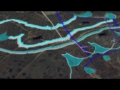
Kansas City area discussion going on here: https://www.facebook.com/groups/1707573296152799/
Miles Flansburg wrote:Howdy A Tee welcome to permies. When I am marking out a contour for a swale, I do not worry to much about getting within an inch or two on the first pass. I know that my shovel or machine will be digging out soil and placing it up on a berm . This is not going to end up being within a half inch, and maybe not even within a half a foot. I know that I will have to come back and redo the top of the berm to find my final level./
Welcome! Understood about the initial work and not bothering about dressing too much.
Miles Flansburg wrote:As the swale will be used to collect and spread water I feel that the top of the berm being level is more important than the bottom of the swale.
I think they are equally important as an uneven tilt or dead spots in the bottom of the swale will cause water to collect in certain area's over others. Totally agree on the berm uniformity though.
Miles Flansburg wrote:The top will determine where the water overflows. Where it overflows naturally becomes the spillways. If I need more soil to make the berms more level I can always take more from the bottom of the swale even though this may leave small, deeper , ponds than what may be elsewhere all along the swale.
Agreed... also there is a lot of mixed terminology as some people refer to the actually mound/ridge as berm... whereas others (I assume you and I) are referring to the lip between the ditch and the mound as berm?
Miles Flansburg wrote:In your example, If you are getting point E from point D and then points F and G from D than everything from D onward will be lower and possibly lower still as you continue?
To compensate you may have to make two more points, C and a half, and C and 3/4 to get 28" on either side of point D ? And get point E from point C and 3/4 ?
Yes the issue is that there will be a linear error for all forward points, so I've sort of been back tracking every now and then. Thanks so much for your suggestions and I will be trying out your tip!
Dan Grubbs wrote:First off, I have to ask the question I should have asked myself before I started a couple of earthworks projects ... can I design a different solution and achieve nearly the same results without earthworks. If not, then I consider earthworks. If I can get close with different design, then I'll avoid the earthworks. I know it's not as fun, but doing surgery should follow other solutions, right?
Dan Grubbs wrote:That out of the way ... I agree with Miles in that your tolerances are probably less critical than you may think. I use a bunyip level for establishing contours and I prefer them to lasers. What laser can go around a corner or go through an object? What A-frame level can span 15-20 feet and miss a big tractor tire rut? The bunyip is my preferred tool.
Dan Grubbs wrote:
Comment 1 - Unless you're really really good with a backhoe (track hoe, excavator), your 1/2-inch variance may not matter when you're roughing in your swale. As Miles said, you can groom things to better tolerances if you think you need that exactness. I personally found that I don't worry about a 1/2-inch variance when the measurement from the bottom of the ditch to the top of the berm is at least 24 inches. I don't see a structural issue if there is a wavering of even an inch of the top of the berm. I know for a fact the berm soil won't settle evenly over time and the contour of the top of the berm will vary more than an inch. That's my experience, at least.
Dan Grubbs wrote:Comment 2 - If I want to ensure that I don't continue a linear error and magnify it down to the end of the contour line, I do what I call back points -- a kind of back checking. My bunyips are normally made with a clear hose of 25 feet (about 8 meters). If I measure back points, I'll start with my back pole at the first steak (A), pull my front pole out about half the distance of the tube and steak there (B), then pull the front pole out the full distance and steak (C). Then set the back level pole at B and check C with the front pole and then pull out front pole to full distance and stake (D). Repeat this process as a double-check way to ensure your contour line is accurate. I have done this, but don't feel it's really necessary because of grooming the berm/ditch to refine things.
1
This is all just my opinion based on a flawed memory
Ben Zumeta wrote:Welcome to permits Andy, sounds like a good project.
Ben Zumeta wrote:I also made the mistake about confusing the importance of level in the bottom and top of swales. Then I saw a video where Bill Mollison explicitly says
“the top of your berm must be perfectly level, the bottom of the swale can have dips and crests, what matters is that it’s permeable.”
Ben Zumeta wrote:This echoes the advice you’ve gotten about the berm ridge/primary spillway.
Ben Zumeta wrote:I have built small French drain “swales” with 4” weeping tile, and in that case saw it as worthwhile to level the bottom of my ditch/swale so the pipe laid flat and help spread the water as it entered the ditch, which I then covered with woody debris and chips to use as a path between hugel beds.

|
Create symphonies in seed and soil. For this tiny ad:
6 Rocket Builds - 3d Plans - Free Heat Bundle
https://permies.com/t/193434/Rocket-Builds-Plans-Free-Heat
|