• Post Reply Bookmark Topic Watch Topic
  • New Topic
permaculture forums growies critters building homesteading energy monies kitchen purity ungarbage community wilderness fiber arts art permaculture artisans regional education skip experiences global resources cider press projects digital market permies.com pie forums private forums all forums
this forum made possible by our volunteer staff, including ...
master stewards:
  • Carla Burke
  • Nancy Reading
  • John F Dean
  • r ranson
  • Jay Angler
  • paul wheaton
stewards:
  • Pearl Sutton
  • Leigh Tate
  • Devaka Cooray
master gardeners:
  • Christopher Weeks
  • Timothy Norton
gardeners:
  • thomas rubino
  • Matt McSpadden
  • Jeremy VanGelder

Drones for aerial reconnaissance?

 
pollinator
Posts: 1113
Location: Pac Northwest, east of the Cascades
336
hugelkultur forest garden trees chicken wofati earthworks building solar rocket stoves woodworking homestead
  • Mark post as helpful
  • send pies
    Number of slices to send:
    Optional 'thank-you' note:
  • Quote
  • Report post to moderator
Hello folks,

New here and this is my first thread started besides my introduction. I did a search and only found two threads on drones and one seemed to not exist anymore. So figured I would start a new thread.

I had realized that when searching for land being able to get a good bird's eye view to explore the property could be a good plan, and Google Earth images only get so much detail. So started researching drones multicopters and the like.

To get a decent set up it costs around $1,000 from what I have found. Today I just picked up a little practice quad copter with a built in 720p camera for $230 to help learn to fly and control a more expensive quad copter in the future.

My main ideas are that while looking at properties I can use a drone to scout features that I can then explore on foot after spotting them from the air. It could also be used to have a visual record of properties using the camera to record the properties. Thus making properties easier to compare. Once I find a property, it could be used to check fence lines, map the property for designs, scout wild game, further explore the features of the property, remotely check projects (like working on one end of a pipe and checking to see if the water is still flowing at the other end), and likely many other things.

So I am curious if anyone else has put remote vehicles to use?
 
pollinator
Posts: 976
Location: Porter, Indiana
166
trees
  • Mark post as helpful
  • send pies
    Number of slices to send:
    Optional 'thank-you' note:
  • Quote
  • Report post to moderator
I like to keep an up to date map of all the trees / vines planted out at my orchard and have considered getting one of those quad copters to take pictures of the place that I can label with variety names. Eventually I'll probably get one, but so far there have been two factors stopping me. The first is my county has a pretty good online GIS system with two or three foot elevation contour lines overlaid onto Google maps. At least for tree-scale features, that amount of information has been sufficient. The second factor is that there is an active flight school / flying club nearby, so by chipping in $50 towards the price of gas it's easy to find someone to take me up in a Cessna so I can take pictures of the property with a nice SLR camera.
 
Devin Lavign
pollinator
Posts: 1113
Location: Pac Northwest, east of the Cascades
336
hugelkultur forest garden trees chicken wofati earthworks building solar rocket stoves woodworking homestead
  • Mark post as helpful
  • send pies
    Number of slices to send:
    Optional 'thank-you' note:
  • Quote
  • Report post to moderator

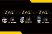
John Wolfram wrote:I like to keep an up to date map of all the trees / vines planted out at my orchard and have considered getting one of those quad copters to take pictures of the place that I can label with variety names. Eventually I'll probably get one, but so far there have been two factors stopping me. The first is my county has a pretty good online GIS system with two or three foot elevation contour lines overlaid onto Google maps. At least for tree-scale features, that amount of information has been sufficient. The second factor is that there is an active flight school / flying club nearby, so by chipping in $50 towards the price of gas it's easy to find someone to take me up in a Cessna so I can take pictures of the property with a nice SLR camera.


Ah yes, having access to trips in a real plane would negate the need to have you own remote vehicle for ariel photography pretty much. Though eventually $50 a plane ride would add up to the cost of getting a quad copter of your own. I don't have that sort of access to a flight school so the remote vehicle seemed like a good idea for me.

Nice to hear though that someone else has considered the option. If you do end up going for a drone eventually, make sure to get a lower cost smaller one to practice with first. It is not exactly easy to learn to fly these things, so a $40-$100 drone you can crash without stressing out is a good way to feel comfortable once you get the higher quality $1000 one.
 
gardener
Posts: 658
Location: Wheaton Labs, MT and Tularosa, NM
552
10
  • Mark post as helpful
  • send pies
    Number of slices to send:
    Optional 'thank-you' note:
  • Quote
  • Report post to moderator
In the spirit of every element having multiple functions: you could have a side business offering those aerial views to real estate agents.
 
John Wolfram
pollinator
Posts: 976
Location: Porter, Indiana
166
trees
  • Mark post as helpful
  • send pies
    Number of slices to send:
    Optional 'thank-you' note:
  • Quote
  • Report post to moderator

Devin Lavign wrote:Though eventually $50 a plane ride would add up to the cost of getting a quad copter of your own. I don't have that sort of access to a flight school so the remote vehicle seemed like a good idea for me. Nice to hear though that someone else has considered the option. If you do end up going for a drone eventually, make sure to get a lower cost smaller one to practice with first.


VERY VERY true about going with the low cost option first. As a kid I had a few RC planes. I think the gas powered one met its demise on the second "flight" when it nose dived into the ground after climbing for a few seconds. The electric one fared better, but boy did I break a lot of propellers.

Even if there isn't a flight school around, if there is a small airport nearby you might be able to find someone with a small plane who would love to help you with an aerial shoot if you pitch in for gas. Considering the $100 hamburger is well established part of general aviation, I'd imagine it would not be too difficult to convince one of your local pilots to take you up for a photo shoot.
 
Devin Lavign
pollinator
Posts: 1113
Location: Pac Northwest, east of the Cascades
336
hugelkultur forest garden trees chicken wofati earthworks building solar rocket stoves woodworking homestead
  • Mark post as helpful
  • send pies
    Number of slices to send:
    Optional 'thank-you' note:
  • Quote
  • Report post to moderator
The area I am looking for land is pretty remote, not a place with a lot of air ports, or even people. The closest town to the area is literally a one business town. Just one gas station/general store and two historic buildings.

I just realized something however. If you are close to an airport, you can't legally fly a drone with in 5 miles of an airport. Airports are a no fly zone according to the FAA, which actually makes some sense due to the physical danger of the aircraft colliding and the possible radio emission disturbances.
 
Devin Lavign
pollinator
Posts: 1113
Location: Pac Northwest, east of the Cascades
336
hugelkultur forest garden trees chicken wofati earthworks building solar rocket stoves woodworking homestead
  • Mark post as helpful
  • send pies
    Number of slices to send:
    Optional 'thank-you' note:
  • Quote
  • Report post to moderator

Fred Tyler wrote:In the spirit of every element having multiple functions: you could have a side business offering those aerial views to real estate agents.


I actually figure that when I go looking at property the agent will likely start asking a lot of questions and I might be able to offer such a service at that time. The agent I am looking at going through specializes in remote rural properties, and I could see him being very interested in such a project. However, the FAA actually says it is illegal to use drones commercially. A lot of people are testing this rule by not selling the drone time, but selling the video editing of the footage of a drone flight or other "work arounds" of the law. Hollywood even lies about it's drone use in movies, claiming they used all sorts of other apparatus when they actually used drones for a shot, due to worry about being prosecuted for using a drone commercially.
 
Fred Tyler
gardener
Posts: 658
Location: Wheaton Labs, MT and Tularosa, NM
552
10
  • Mark post as helpful
  • send pies
    Number of slices to send:
    Optional 'thank-you' note:
  • Quote
  • Report post to moderator
Maybe the FAA regulations have changed? CNN used one for its coverage of the 50th anniversary of the "Bloody Sunday" Selma march. Jon Stewart makes light of it in this clip (skip to 4:30) from 3/9/15.

Skyfail

Seems fairly commercial to me.
 
Devin Lavign
pollinator
Posts: 1113
Location: Pac Northwest, east of the Cascades
336
hugelkultur forest garden trees chicken wofati earthworks building solar rocket stoves woodworking homestead
  • Mark post as helpful
  • send pies
    Number of slices to send:
    Optional 'thank-you' note:
  • Quote
  • Report post to moderator

Fred Tyler wrote:Maybe the FAA regulations have changed? CNN used one for its coverage of the 50th anniversary of the "Bloody Sunday" Selma march. Jon Stewart makes light of it in this clip (skip to 4:30) from 3/9/15.

Skyfail

Seems fairly commercial to me.


Likely the pilot used one of the work arounds I mentioned, not selling his flying the drone, but the editing of the footage, or some such similar excuse. The Daily show cut the mention of some new FAA ruling, maybe they applied for and received the permit? As of yet I don't know of the FAA actually prosecuting anyone for flying for profit, but they insist it is illegal to use a drone commercially. This is what stopped Amazon from going ahead with their drone delivery project, and there was a pizza company who was trying to work on drone delivery who were told they can't.

some links to info on the subject
https://www.techdirt.com/articles/20140624/16403127676/faa-says-using-drones-any-even-remotely-commercial-realm-is-not-allowed.shtml

http://3drobotics.com/2015/02/us-drone-laws-faa/
 
Devin Lavign
pollinator
Posts: 1113
Location: Pac Northwest, east of the Cascades
336
hugelkultur forest garden trees chicken wofati earthworks building solar rocket stoves woodworking homestead
  • Mark post as helpful
  • send pies
    Number of slices to send:
    Optional 'thank-you' note:
  • Quote
  • Report post to moderator
So figured I would update some info on this thread.

1st, the legality of commercial drone use. It is legal, however you need a special permit and it is a two person operation. One to fly one to use the camera. And often times they require a third to be spotter. But commercial use of drones is viable option for folks.

2nd, the advances have been going in leaps and bounds in just a year. Collision avoidance is now becoming common place on the better hobby grade drones. Lot more reliability and stability. As well as a lot more ease of use for non pilots.

3rd, any drone over 1/2 a pound requires registration. Think of it like a Ham radio license without having to even take a test. The reason for it is to be able to decrease the dumb pilots by being able to locate and fine them. As well as give a moderate amount of loss protection in case of fly aways or crashes that you can't find.

4th, toy grade drones have come a long ways and you can now get toy grade drones around or under $200 that are aprox at the level of hobby drones of 2 yrs ago. This makes drone tech a lot more affordable to those who don't want to make an expensive hobby out of it, but just want a simple camera drone to fly around checking fence lines, or inspecting the upper story of their trees, or trying to locate their stray livestock, etc..
 
Devin Lavign
pollinator
Posts: 1113
Location: Pac Northwest, east of the Cascades
336
hugelkultur forest garden trees chicken wofati earthworks building solar rocket stoves woodworking homestead
  • Mark post as helpful
  • send pies
    Number of slices to send:
    Optional 'thank-you' note:
  • Quote
  • Report post to moderator
Thought I would give this thread a little update as I have noticed drone use in homesteading videos becoming more and more common.

Wranglerstar
Pure living for Life
Doug and Stacy Off Grid
Better Together Life
45 Degrees North Off Grid

and so many more youtube homestead channels are using drones.

I suspect this is just the start, and a lot of great uses for drones will be explored in the near future. With these channels pioneering the use of them for homesteading, more and more uses for homesteaders having a drone will be found.
 
pollinator
Posts: 1475
Location: Zone 10a, Australia
23
  • Mark post as helpful
  • send pies
    Number of slices to send:
    Optional 'thank-you' note:
  • Quote
  • Report post to moderator
As a side business I would rather suggest drones who discover cocatoos and other pesky parrots and shoo them off. I would safe fruit growers millions in netting costs. It would have to be an intelligent drone as these birds are very very smart.
 
What a beautiful glass! Yoink! This glass is now the property of this tiny ad:
Freaky Cheap Heat - 2 hour movie - HD streaming
https://permies.com/wiki/238453/Freaky-Cheap-Heat-hour-movie
reply
    Bookmark Topic Watch Topic
  • New Topic