10 Podcast Review of the book Just Enough by Azby Brown
will be released to subscribers in:
soon!

|

|

|

|

|


 1
1
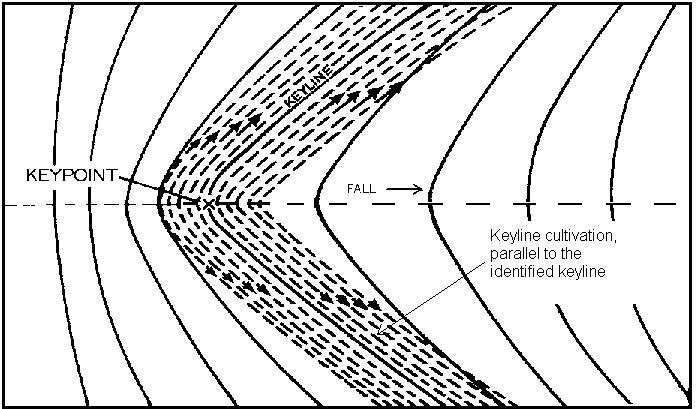
"...In the absence of a proper survey having been completed I would stake a series of contours over the site and paint-mark (or ribbon) the stakes different colours that alternate from one contour to the next (2 colours should do) so that you can differentiate between each marked contour.
Then start marking out the guideline offsets again using alternate colours (though different to the contour colours) and then compare these offsets to the contours. You're doing here what we'd normally do on the screen following a detailed contour map.
If the guideline offsets are going where you want them to then go back to the guideline and adjust it and try again (and again!!) until you're satisfied..."
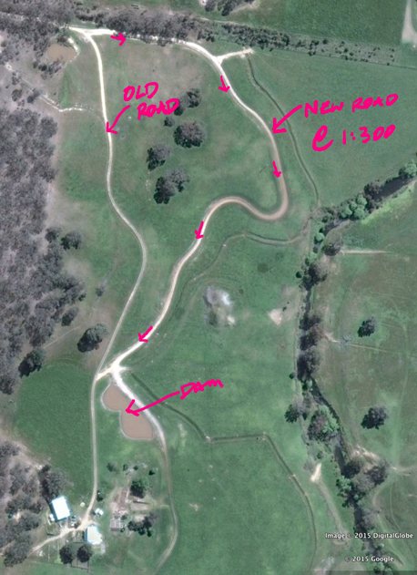
 ). Anyways he was setting out a 0.25 hectare orchard following the contour as per the logic recommended at the PDC and had put stakes in the ground following the different contours and strung string between each stake — so he had marked contour lines effectively. It was diabolical from a land use and access perspective, no equidistance, some rows were 1m apart and some 10m apart such were the shape of the contours on this hillside.
Regrarians Ltd.
www.Regrarians.org
1
Regrarians Ltd.
www.Regrarians.org


|
I have never sensed the force being as strong as in this tiny ad:
Contemplate spending the next 20 years puttering in permaculture projects
https://wheaton-labs.com/bootcamp
|