• Post Reply Bookmark Topic Watch Topic
  • New Topic
permaculture forums growies critters building homesteading energy monies kitchen purity ungarbage community wilderness fiber arts art permaculture artisans regional education skip experiences global resources cider press projects digital market permies.com pie forums private forums all forums
this forum made possible by our volunteer staff, including ...
master stewards:
  • Nancy Reading
  • Carla Burke
  • r ranson
  • John F Dean
  • paul wheaton
  • Pearl Sutton
stewards:
  • Jay Angler
  • Liv Smith
  • Leigh Tate
master gardeners:
  • Christopher Weeks
  • Timothy Norton
gardeners:
  • thomas rubino
  • Jeremy VanGelder
  • Maieshe Ljin

Detailed Topographic Maps with 2' contour interval

 
Posts: 19
Location: Rural Western North Dakota Zone 3
23
7
forest garden hunting trees food preservation wood heat homestead
  • Mark post as helpful
  • send pies
    Number of slices to send:
    Optional 'thank-you' note:
  • Quote
  • Report post to moderator
Does anyone have a source for topographic maps that have contour lines for every 2 feet of elevation?

I have seen 1 topo map with 2 foot contour spacing and it was for a proposed sub-division. The sub-division plat map was overlayed onto the detailed topo map.

I live in the Boise Idaho area in a sub-division of 5-acre properties. Such a map would help me in the intitial design of swales, etc.

I have called the city hall, county assessor, and land records division with no luck.

The most detailed maps I have found are the USGS 1:24,000 scale with contours intervals every 40 feet.
 
Posts: 156
9
  • Mark post as helpful
  • send pies
    Number of slices to send:
    Optional 'thank-you' note:
  • Quote
  • Report post to moderator
Simple Surveying for Farmers by Frank Debenham will show you how to do it yourself.
I had to order it from Australia. P.A. Yoeman's mentions this book as a good resource in Water for Every Farm
Take measurements and make a plaster mold of your land's contours. And you have a forever map that you can pass on to the next steward. Whether you sell the land or pass it on, it will increase the value of the land.
Not the shortest rout form point a to point b, however, you will have intimate knowledge of the land which a map will never give you.
You can also superimpose a google map with contours using sketchup and set the intervals to 2 feet, however, this was not accurate on the one's I did, but it was a rough approximation. Good enough for rough planning. I had a youtube link for this, but I can't find it now.
Maybe those folks paid someone to survey the land, that is one route too.
 
Tom Davis
Posts: 156
9
  • Mark post as helpful
  • send pies
    Number of slices to send:
    Optional 'thank-you' note:
  • Quote
  • Report post to moderator
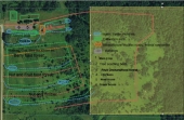
This is what the sketchup looks like -- however my knowledge of the land tells me it is different, but good rough starting point.
Maybe it is helpful
sample-contour-sun-angle-map.jpg
[Thumbnail for sample-contour-sun-angle-map.jpg]
 
Posts: 71
Location: the state of jefferson - zone 7
  • Mark post as helpful
  • send pies
    Number of slices to send:
    Optional 'thank-you' note:
  • Quote
  • Report post to moderator
We, too, would very much like a detailed topographic map of our site. Especially since the terrain is very very complex and convoluted. I suspect that making this map using traditional surveying methods will be unrealistically time consuming (though this book sounds very interesting, and I plan to get a hold of it!) for our large property, so we are considering using a technology called "LIDAR" which makes a topo map from data gathered via airplane flying over the site. I found a paper reporting a study that was done testing it's acuracy, which is remarkably high even in dense canopy (which me mostly have). The 40' topo lines that are available to us are simply not tight enough to do much real planning in this complex terrain.

However, for another site I'm working on, this data might be sufficient, and I am struggling to figure out a GIS program, and get that data into it from the web. If anyone has experience with QGIS or other open source mapping program, I would very much appreciate a little guidance!

--Joshua
 
steward
Posts: 7926
Location: Currently in Lake Stevens, WA. Home in Spokane
350
  • Mark post as helpful
  • send pies
    Number of slices to send:
    Optional 'thank-you' note:
  • Quote
  • Report post to moderator
I am guessing that the 2' contour maps that is referring to were from a special survey that the developer of the site paid for. Perhaps ordered by the planning commission, or used for bidding wars between excavator companies.

On many sites (steep, or very irregular) the resulting map would become a black (or whatever color the contour lines were drawn) blob.

Such a tool would be priceless for many earthworks projects. The plaster mold would be even better. The original, AND several copies so you could "Dremel tool" your ideas, and a final results version. Wouldn't it be cool to have Before/After copies? A great selling aid if you ever wanted to sell the property, or just so the kids & grandkids could see what grandpa did with his land.

Please, if anybody knows a source for any maps more detailed than the 40' contours of the USGS maps, please post it.


Armin Voigt
Posts: 19
Location: Rural Western North Dakota Zone 3
23
7
forest garden hunting trees food preservation wood heat homestead
  • Mark post as helpful
  • send pies
    Number of slices to send:
    Optional 'thank-you' note:
  • Quote
  • Report post to moderator
Tom,
Using sketchup to superimpose a google map with contours sounds like a great idea and should work for my planning. I just downloaded sketchup, let me know if you ever find that youtube link on how its done. Thanks
 
Armin Voigt
Posts: 19
Location: Rural Western North Dakota Zone 3
23
7
forest garden hunting trees food preservation wood heat homestead
  • Likes 1
  • Mark post as helpful
  • send pies
    Number of slices to send:
    Optional 'thank-you' note:
  • Quote
  • Report post to moderator
Tom,
Is this the youtube link that you were referring to?

 
Tom Davis
Posts: 156
9
  • Mark post as helpful
  • send pies
    Number of slices to send:
    Optional 'thank-you' note:
  • Quote
  • Report post to moderator
yeppers, that's the one thanks!
I looked at a bunch of different sketch up vids describing this process.
For me, a guy who has used sketch up for maybe 10 hours total, this guy's method was by far the easiest way to make contours at whatever interval you want.
Actually, thinking back, the map I posted was 4' intervals, since 2' looked way to crowded on that 1 acre site.
So, a larger tract would be even less comprehensible @ 2' intervals, as someone else mentioned.
 
Posts: 1273
Location: Central Wyoming -zone 4
46
hugelkultur monies dog chicken building sheep
  • Mark post as helpful
  • send pies
    Number of slices to send:
    Optional 'thank-you' note:
  • Quote
  • Report post to moderator
this is a great thread and thank you very much for sharing the link for the video, if only my POS computer would actually let me download sketchup...
 
Posts: 425
Location: Fairbanks, Alaska
48
  • Likes 1
  • Mark post as helpful
  • send pies
    Number of slices to send:
    Optional 'thank-you' note:
  • Quote
  • Report post to moderator
You might want to look into whether there is LIDAR data available for your location...the USGS has National Elevation Datasets available in resolutions from 3 to 30 meters--not quite 2 feet, but there are other sources which might have higher resolution data. I lucked out; there was a LIDAR survey for a potential pipeline corridor that included our land, and the resolution was within inches. So now I've been able, through some software gymnastics with various free/demo GIS applications, to convert and import a super high resolution 3d representation into Sketchup. I hope to use this for planning and modeling, and am particularly interested in using Sketchup's functionality to track the sun and see where the shadows lie on any particular date.

sketchup.png
[Thumbnail for sketchup.png]
Data imported into Sketchup
image.png
[Thumbnail for image.png]
LIDAR file
 
Posts: 39
Location: Central Virginia, USA
2
  • Mark post as helpful
  • send pies
    Number of slices to send:
    Optional 'thank-you' note:
  • Quote
  • Report post to moderator

John Polk wrote:I am guessing that the 2' contour maps that is referring to were from a special survey that the developer of the site paid for. Perhaps ordered by the planning commission, or used for bidding wars between excavator companies.

On many sites (steep, or very irregular) the resulting map would become a black (or whatever color the contour lines were drawn) blob.

Such a tool would be priceless for many earthworks projects. The plaster mold would be even better. The original, AND several copies so you could "Dremel tool" your ideas, and a final results version. Wouldn't it be cool to have Before/After copies? A great selling aid if you ever wanted to sell the property, or just so the kids & grandkids could see what grandpa did with his land.

Please, if anybody knows a source for any maps more detailed than the 40' contours of the USGS maps, please post it.


I contacted my County. I told them I need a topo map for my property that had anywhere from 2 foot to 5 foot intervals. They transferred me to another office within the county which said I could either pick up a map (made with aerial photo technology) that had 4 foot intervals or they could email it to me. So they emailed it and it was excellent. Much better than I hoped for and much more accurate than the USGS map which is pretty poorly done. Try contacting the county and seeing what they have for you. I had spent hours online trying to find a resource that had the topo maps online, but I ended up calling the county when my search was unfruitful. Good luck.

Diego

PS the map was also FREE! A surveyor would have charged me $4000 to survey a 10 acre parcel with 5 ft intervals which is actually a fair market price for the work. This can save you a whole lot of money.
 
Posts: 17
  • Likes 1
  • Mark post as helpful
  • send pies
    Number of slices to send:
    Optional 'thank-you' note:
  • Quote
  • Report post to moderator
Hi Armin,

I recently had the Soil Conservation Service come to look at partnering in cost share and wetland restoration projects for my 12 acres in Sandpoint. I asked if a map with 2' contour intervals was available and without blinking, he said he would order one. You may call SCS and ask some questions.
 
Instructor
Posts: 112
Location: Reno, NV
22
5
  • Mark post as helpful
  • send pies
    Number of slices to send:
    Optional 'thank-you' note:
  • Quote
  • Report post to moderator
Remember, the map is not the territory.

planning using available resources is a good start, but always ground truth before and while doing earthworks and implementation.

making quick and dirty contour maps using a laser level and GPS unit is relatively cheap and easily accessible.

We are teaching people how to do this and other design, planning and management activities at our upcoming Whole Farm Fertility Course in Montana.

If you would like to participate in a 5-day immersion in the concepts of Holistic planned grazing and Keyline Design, then come to our workshop in June in Wilsall, Montana. we will be demonstrating the use of the Yeomans Plow, surveying for Keyline Design, Pasture assessment, and more.

for info on this workshop and to register you can visit our website
http://www.montanawholefarmfertility.com/

If you have any specific questions or comments, please post to our permies.com thread
https://permies.com/t/23837/rockies/Montana-Farm-Fertility-Workshop-Learn

Thank you
the Montana Whole Farm Fertility Team
 
Instructor
Posts: 113
Location: Corvallis, Oregon
21
  • Likes 1
  • Mark post as helpful
  • send pies
    Number of slices to send:
    Optional 'thank-you' note:
  • Quote
  • Report post to moderator
Ultimately, mapping resources vary greatly from county to county. Typically the more "economically valuable" the land, the better the mapping. Here in Benton County, Oregon, we get free lidar derived 2' contour maps. Absolutely golden for working with a base map. But in nearby Lane county, outside of Eugene metro area, only 20' contour maps, and only an expensive survey for detailed contours.

The sketch up fills in some of the blanks, but doesn't capture the detail and subtleties that Lidar or an on-ground survey does.

I would definitely expect Boise to have good contour maps available.

Check out this awesome Lidar website for the State of Oregon:
http://www.oregongeology.org/dogamilidarviewer/
 
Posts: 110
2
  • Mark post as helpful
  • send pies
    Number of slices to send:
    Optional 'thank-you' note:
  • Quote
  • Report post to moderator
That's a really great tool, thanks.
gift
 
Companion Planting Guide by World Permaculture Association
will be released to subscribers in: soon!
reply
    Bookmark Topic Watch Topic
  • New Topic