|

|
|
|
|

|
|

|

|

|
 1
1


 2
2
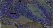
![[Thumbnail for google_maps.JPG]](/t/106985/a/73895/google_maps.JPG "Filename: google_maps.JPG
Description: Open Google Maps")
![[Thumbnail for gm_terrain.JPG]](/t/106985/a/73896/gm_terrain.JPG "Filename: gm_terrain.JPG
Description: Select Terrain")
![[Thumbnail for gmt_view.JPG]](/t/106985/a/73897/gmt_view.JPG "Filename: gmt_view.JPG
Description: Zoom In as Needed")
Dave's SKIP BB's / Welcome to Permies! / Permaculture Resources / Dave's Boot Adventures & Longview Projects

Skill verified by gir bot")

Skill verified by Mike Haasl")

Skill verified by Mike Haasl")

Skill verified by Nicole Alderman")

Skill verified by Nicole Alderman") 4
1
2
4
1
2
James 1:19-20
Not all those who wander are lost - J. R. R. Tolkien
2
Michael Adams wrote: I just want to be able to draw a line on Google Earth with automatic pin points dropped in on whatever measurement I enter. For fruit tree planting, I want a pin point every 10 feet on a drawn line of 1000'. That way I'll have a more accurate idea of how growth shading is going to look in my food forest. Its very tedious to go back to a drawn line and measure out 10 feet with computer mouse and plop a pin. Is this possible to do?

|
Clowns were never meant to be THAT big! We must destroy it with this tiny ad:
Contemplate spending the next 20 years puttering in permaculture projects
https://wheaton-labs.com/bootcamp
|