|
|

|

|

|

|
|
|
|
|
|
|
|

|

|

|

|
|
 6
6


"Where will you drive your own picket stake? Where will you choose to make your stand? Give me a threshold, a specific point at which you will finally stop running, at which you will finally fight back." (Derrick Jensen)
Learn more about my book and my podcast at buildingabetterworldbook.com.
Developer of the Land Notes app.
1
Porch sitting is my favorite thing


 3
3
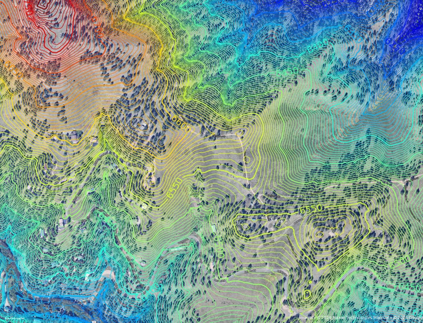
![[Thumbnail for Contour_Map.jpg]](/t/97513/a/68758/Contour_Map.jpg "Filename: Contour_Map.jpg
Description:") 1
1
"Where will you drive your own picket stake? Where will you choose to make your stand? Give me a threshold, a specific point at which you will finally stop running, at which you will finally fight back." (Derrick Jensen)
2
Permies is awesome!!!
2
 1
1
![[Thumbnail for contour-map.jpg]](/t/97513/a/252667/contour-map.jpg "Filename: contour-map.jpg
Description:")
How permies.com works
What is a Mother Tree ?

Skill verified by gir bot")

| I agree. Here's the link: http://stoves2.com |